Places near here
Photo credits
- National Inventory of Architectural Heritage
- Alexander Redfern, Wikimedia Commons · CC BY-SA 4.0
- Kmcnamee, Wikimedia Commons · CC BY-SA 4.0
- Hywel Williams, Geograph · CC BY-SA 2.0
- Mike Searle, Geograph · CC BY-SA 2.0
- kevin higgins, Geograph · CC BY-SA 2.0
- The original uploader was Ww2censor at English Wikipedia ., Wikimedia Commons · CC BY-SA 2.0
- Mike Searle, Wikimedia Commons · CC BY-SA 2.0
- Rasbak, Wikimedia Commons · CC BY-SA 3.0
- Paul Evans from London, United Kingdom, Wikimedia Commons · CC BY 2.0
 Glengalla BridgeBridge · 639 yd
Explorer Tom Glengalla Bridge has got concrete that looks like it was poured by someone in a hurry and then left out in the rain.…
 Goats BridgeBridge · 1.2 mi
Explorer Tom Goats Bridge in Curragh is exactly what you’d expect from a bridge named after animals: a bit of a mess but functional.…
 Goatenbridge, Ballybacon / GrangeGAA ground · 1.3 mi
 The VeeViewpoint · 1.9 mi
Explorer Tom The Vee thinks the road leading to it is a bit of a wimp for being so straight and predictable all the time. It prefers…
 Liam Lynch MonumentMonument · 2.3 mi
Explorer Tom The Liam Lynch Monument is still counting exactly how many cups of tea it took to build this thing in the first place.…
 Castle Grace (in ruins)Castle, Anglo-Norman masonry castle · 2.4 mi
Explorer Tom Castle Grace is absolutely sick of people asking if it’s a Bermingham place or a de Wigornia one, it just wants some…
 KnockmoylanMountain / peak · 2.6 mi
Explorer Tom Knockmoylan sounds as though someone has knocked on the mountain and forgotten to wait for an answer. At roughly 768…
 KnockmealdownMountain / peak · 3.2 mi
Explorer Tom Knockmealdown stands on a county border and still manages to keep the actual highest point for Waterford. Its ridge…
Ardfinnan GAA pitchGAA ground · 3.5 mi Ballindoney Castle (in ruins)Castle, tower house · 5.0 mi
Explorer Tom Ballindoney Castle has a fifth-storey room that looks like it’s trying to escape gravity, which is very cheeky for a…
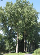 Hybrid Black Poplar6.1 mi
Explorer Tom Hybrid Black Poplar in County Tipperary is having a massive feud with the next village over because they stole one of…
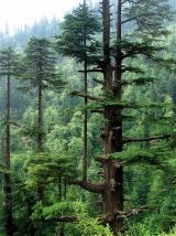 Deodar Cedar6.4 mi
Explorer Tom Deodar Cedar in County Tipperary keeps getting picked on by the wind because its pointy top looks exactly like a giant…
More castles and forts in County Tipperary · All of County Tipperary

What do you know about this place?Tap to add a comment or ask a question