DDiscover AloneMapAbout

Castle John

Castle, tower house

The monument record does not grant public access. Check the route and ask the landowner before entering private land.

What survives
Recorded monument
What do you know about this place?Tap to add a comment or ask a question

What you write will be public.

What is recorded here

On level ground and currently in a farmyard with a 19th-century farmhouse immediately to the W, surrounded by gently undulating pastureland, with a large pond c. 40m to the S. The Ormond Deeds (vol. 6, 13) of 1584 note that this was part of the lands of 'James Tobyn, of Killahe'. According to the Civil Survey (1654-6)…

Read the whole record
On level ground and currently in a farmyard with a 19th-century farmhouse immediately to the W, surrounded by gently undulating pastureland, with a large pond c. 40m to the S. The Ormond Deeds (vol. 6, 13) of 1584 note that this was part of the lands of 'James Tobyn, of Killahe'. According to the Civil Survey (1654-6) on the lands of Castlejohn there stood 'a castle' which in 1640 was under the proprietorship of 'James Tobyn of Killaghy Esqr. Irish Papist' (Simington 1931, vol. 1, 142). This tower house (int. dims. 5.2m N-S; 6.97m E-W) is built with sandstone rubble, roughly coursed, with a base-batter (H 2.1m; Wth 0.3m). Only the modified ground floor, the first floor beneath a pointed vault and the NW angle of the second floor survive. The original entrance is no longer in situ but it appears to have been at the N end of the E wall which is now much modified. The original pointed doorway (H 1.8m; Wth 1.08m) has been re-used as a doorway into a farmbuilding c. 10m to the SW, has a yett-hole at the apex and is constructed largely of limestone with external double chamfer and punch tooling within drafted margins. A mural stairs, currently inaccessible but visible from the outside, rises in the E wall from its N end. The doorway into the ground floor was presumably at the N end of the E wall but no trace of it survives, though there is a later recess (H 1.15m; Wth 0.75m; D 0.6m) in this area. The ground floor, currently used as a storage shed, is much altered and the floor level possibly raised. A doorway has been inserted in the SW angle and a possibly original embrasure (Wth 1.23m) has been modified to become a doorway (H 1.96m) or has been inserted at the E end of the N wall. There is also an area of blocking near the NE angle on the N wall which may be repair. Though now all blocked, the ground floor appears to have been lit by a number of windows as evidenced by two splayed embrasures with crude segmental heads, one towards the W end of the S wall and one at the W end of the N wall, both with blocked outer openings. A wide, straight-sided segmental-headed embrasure at the S end of the E wall may also have contained a window opening. Roughly centrally placed in the W wall at ground level there is a flat-headed recess which appears to be a later insert. There is a wall cupboard at the N end of the W wall. Though no internal floor supports survive, there appears to have been a second floor under the vault as there is a blocked window within a large, centrally-placed, splayed segmental-headed embrasure at this level in the W wall. Though the floor above the vault is largely destroyed, there are the remains of a splayed embrasure at the W end of the N wall (surviving L c. 2m).

From the National Monuments Service (Archaeological Survey of Ireland) record TS072-004001

Places near here

Picture notes
  • Computer-made picture. It does not show this monument.
  • National Inventory of Architectural Heritage
  • kevin higgins, Geograph · CC BY-SA 2.0
  • Computer-made picture. It does not show this mountain top.
  • Computer-made picture. It does not show this walking route.
  • Computer-made picture. It does not show this playground.
  • A.-K. D., Wikimedia Commons · CC BY-SA 4.0
  • A.-K. D., Wikimedia Commons · CC0
Settlement cluster in CastlejohnSettlement cluster · 364 ydTom: I’m here to help · Computer-made picture. It does not show this monument.

Explorer Tom Settlement cluster in Castlejohn has caught my eye in Castlejohn, County Tipperary. I bet a settlement cluster with a name like that could keep me talking all afternoon; I'm already inventing a daft little scene for it, and I'll stop before it turns into history.

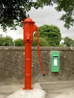
water pump430 yd

Explorer Tom Water pump in Castlejohn has caught my eye in Castlejohn, County Tipperary. I bet a water pump with a name like that could keep me talking all afternoon; I'm already inventing a daft little scene for it, and I'll stop before it turns into history.

Fulacht fia in KiltrassyFulacht fia · 600 ydTom: I’m here to help · Computer-made picture. It does not show this monument.

Explorer Tom Fulacht fia in Kiltrassy has caught my eye in Kiltrassy, County Kilkenny. I bet a fulacht fia with a name like that could keep me talking all afternoon; I'm already inventing a daft little scene for it, and I'll stop before it turns into history.

Knockroe Passage TombVisitor information · 1624 yd

Explorer Tom Knockroe Passage Tomb has caught my eye in County Kilkenny. I bet a visitor information with a name like that could keep me talking all afternoon; I'm already inventing a daft little scene for it, and I'll stop before it turns into history.

Chapel RockMountain / peak · 1.7 miTom: I’m here to help · Computer-made picture. It does not show this mountain top.

Explorer Tom Chapel Rock has caught my eye in County Kilkenny. I bet a mountain / peak with a name like that could keep me talking all afternoon; I'm already inventing a daft little scene for it, and I'll stop before it turns into history.

Saint Nicholas's Catholic ChurchGraveyard/cemetery · 1.7 mi

Explorer Tom Saint Nicholas's Catholic Church has caught my eye in Meallaghmore Upper, County Kilkenny. I bet a graveyard/cemetery with a name like that could keep me talking all afternoon; I'm already inventing a daft little scene for it, and I'll stop before it turns into history.

Bearna Breac LoopWalking route · 1.8 miTom: I’m here to help · Computer-made picture. It does not show this walking route.

Explorer Tom Bearna Breac Loop has caught my eye in County Kilkenny. I bet a walking route with a name like that could keep me talking all afternoon; I'm already inventing a daft little scene for it, and I'll stop before it turns into history.

Children's playground1.8 miTom: I’m here to help · Computer-made picture. It does not show this playground.

Explorer Tom Children's playground has caught my eye in County Kilkenny. I bet a children's playground with a name like that could keep me talking all afternoon; I'm already inventing a daft little scene for it, and I'll stop before it turns into history.

Windgap Village LoopWalking route · 1.8 miTom: I’m here to help · Computer-made picture. It does not show this walking route.

Explorer Tom Windgap Village Loop has caught my eye in County Kilkenny. I bet a walking route with a name like that could keep me talking all afternoon; I'm already inventing a daft little scene for it, and I'll stop before it turns into history.

CarricknagappulMountain / peak · 1.8 miTom: I’m here to help · Computer-made picture. It does not show this mountain top.

Explorer Tom Carricknagappul has caught my eye in County Kilkenny. I bet a mountain / peak with a name like that could keep me talking all afternoon; I'm already inventing a daft little scene for it, and I'll stop before it turns into history.

Killamery High CrossVisitor information · 2.7 mi

Explorer Tom Killamery High Cross has caught my eye in County Kilkenny. I bet a visitor information with a name like that could keep me talking all afternoon; I'm already inventing a daft little scene for it, and I'll stop before it turns into history.

James (Jim) McKennaMemorial · 3.1 mi

Explorer Tom James (Jim) McKenna has caught my eye in County Kilkenny. I bet a memorial with a name like that could keep me talking all afternoon; I'm already inventing a daft little scene for it, and I'll stop before it turns into history.

More castles and forts in County Tipperary · All of County Tipperary

Add to this placeAdd a picture Add a detailed tip Add a story

Explore the map1,087,615 places to discover

Next place · or swipeSettlement cluster in Castlejohn