
What is recorded here
Freestanding three-storey garden front of detached ruined country house, built c.1780, remodelled c.1830. Now ruinous. Elevation comprises recessed centre having Ventian doorway to ground floor, Diocletian window to first floor with dropped keystone and two square-headed openings to second floor, flanked by two-bay projections with square-headed window openings, all window openings having tooled limestone sills. Tooled limestone crenellations supported on corbel tables. Lined-and-ruled rendered walls, stone partly exposed in places. Round-headed doorway with square-headed sidelights having tooled limestone sills. Roofless multiple-bay two-storey outbuilding to south-east, half of building having openings arranged in threes, having tooled limestone eaves course, rubble limestone walls, elliptical carriage archway with tooled voussoirs, and square-headed doorways, some with tooled Gibbsian surrounds, and square-headed window openings with tooled sills.
Although only the façade of this building remains, its status and importance are clearly evident in its formal proportions, large scale, and limestone crenellations. It is archaeologically significant due to the incorporation of a tower house into the structure. The adjacent outbuildings add context to the site. Formerly known as Corbally, it was acquired by the Daly family in 1829, and remodelled after this date.
This does not grant access. Most recorded buildings are privately owned; view them only from public ground unless the owner allows entry.
Places near here
 Church (in ruins)Church · 254 yd
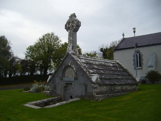 Saint Teresa's Catholic Churchmausoleum · 661 yd
 Enclosure in LissadultaEnclosure · 1110 yd
 Enclosure in Bullaunagh (kiltartan By.)Enclosure · 1393 yd
 Castle (in ruins)Castle, Anglo-Norman masonry castle · 1.1 mi
 Bawn in Cloghaun (loughrea By.)Bawn · 1.6 mi
 KnockapollboyMountain / peak · 3.4 mi
 European ashEuropean ash · 3.7 mi
 HawthornHawthorn · 3.7 mi
 Scalpeen RockNamed rock · 4.1 mi
 KnocknarebanaMountain / peak · 5.0 mi
 Derrybrien Bog SlideHeritage attraction · 5.7 mi
Other information
Photo: Mike Searle · CC BY-SA 2.0