
What is recorded here
From the National Monuments Service (Archaeological Survey of Ireland) record DG036-018
Places near here
Photo credits
- National Inventory of Architectural Heritage
- Maker not stated on source page, commons.wikimedia.org
- Maker not stated on source page, library.hrmtc.com
- Patrice78500, Wikimedia Commons · CC BY-SA 3.0
- Proinsias Carr / Donegal GAA, donegalgaa.ie
- Maker not stated on source page, www.dreamstime.com
- Steven Brown, Geograph · CC BY-SA 2.0
- Donegal Live; individual photographer not named, www.donegallive.ie
- Chris Gunns, Wikimedia Commons · CC BY-SA 2.0
- Picture: Donegal Day Out
- Malene Thyssen, Wikimedia Commons · CC BY-SA 3.0
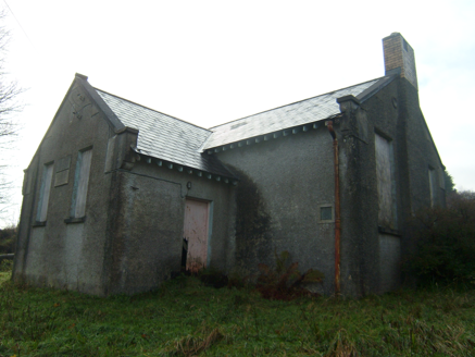 Carrownaganonagh National SchoolSchool · 94 yd
Explorer Tom Carrownaganonagh National School is plotting its grand retirement party in the middle of the field, where the boys'…
 Carrownaganonagh Wedge TombWedge tomb · 407 yd
Explorer Tom Carrownaganonagh Wedge Tomb sits on a gentle slope near Mulroy Bay, wrapped in a grassy cairn that’s been sitting there…
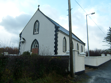 Saint Brigid's Catholic ChurchChurch/chapel · 1.2 mi
Explorer Tom Saint Brigid's Catholic Church was built around 1870 with little trefoil motifs cut into its roof kneeler stones. A…
 Megalithic tomb in Gortmacall MoreMegalithic tomb · 1.4 mi
Explorer Tom Megalithic tomb in Gortmacall More is half-hidden behind a hedge-grown field fence, with three stones bulging out from…
 Loughsalt MountainMountain / peak · 1.7 mi
Explorer Tom Right then, we’re heading up Loughsalt Mountain, a proper peak in County Donegal that sits at 469 metres. It’s the sort…
 Moyle View Park, Milford GAAGAA ground · 2.1 mi
 Mapped graveyardGraveyard · 2.3 mi
Explorer Tom This unnamed graveyard in County Donegal had a massive falling out with the next village over who stole their windmill…
 The LagoonRestaurant · 3.0 mi
Explorer Tom The Lagoon sounds like a place where your food will swim away if you blink. Keep one eye on your plate and one on the…
 Termon GAA GroundsGAA ground · 3.2 mi
 Battle at Doon Rock, KilmacrennanBattle · 4.2 mi
Explorer Tom Battle at Doon Rock, Kilmacrennan in County Donegal is where Sir Cahir O'Doherty finally lost his battle against a…
 Drummonaghan WoodForest recreation place · 4.4 mi
Explorer Tom Drummonaghan Wood is only about a kilometre from Ramelton, yet its trees make the busy old town feel a thoughtful…
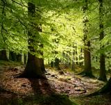 European Beech4.7 mi
Explorer Tom European Beech in County Donegal would complain to the council about the lack of shade during peak afternoon hours and…
More archaeology and monuments in County Donegal · All of County Donegal

What do you know about this place?Tap to add a comment or ask a question