
Places near here
Photo credits
- A.-K. D., Wikimedia Commons · CC BY-SA 4.0
- Humphrey Bolton, Geograph · CC BY-SA 2.0
- National Inventory of Architectural Heritage
- Sitomon, Wikimedia Commons · CC BY-SA 2.0
- A.-K. D., Wikimedia Commons · CC0
Explorer Tom Castle in Owning has a least favourite visitor: the guy who keeps asking if it’s haunted. It’s just a motte with a…
 TobernathullaHoly well · 774 yd
Explorer Tom Tobernathulla has no hint of anything there except my phone's GPS saying otherwise. What would it say to its younger…
 TobernamonineHoly well · 971 yd
Explorer Tom Tobernamonine is a holy well in Glencommaun, but right now it looks more like a puddle with ambition. A fox took charge…
 Dwyer Homestead and Pond, BregaunVisitor information · 1408 yd
Explorer Tom Dwyer Homestead and Pond, Bregaun has a fiddler who played there all night until the fish started humming along in…
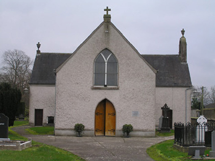 Catholic Church of the AssumptionChurch/chapel · 1.1 mi
Explorer Tom Catholic Church of the Assumption in Owning, County Kilkenny predates Catholic Emancipation, so it’s seen it all. It…
 Kilmacoliver HillMountain / peak · 1.1 mi
Explorer Tom Kilmacoliver Hill is secretly proud of a single potato that grew on its summit in 1902, treating it like a national…
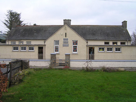 Owning Convent National SchoolSchool · 1.1 mi
Explorer Tom Owning Convent National School was built on a bargain that saved the nuns a lot of money. The standard design means it…
 European Yew1.1 mi
Explorer Tom European Yew is in a long, bitter feud with the rain because it keeps making the ground too slippery for its taste. It…
Woodland LoopWalking route · 1.2 miExplorer Tom Woodland Loop in County Kilkenny is where a dance in 1790 went so wild that the trees still feel dizzy trying to keep…
Irish Republic 1916-2016Memorial · 1.4 miExplorer Tom Irish Republic 1916-2016 is a memorial in County Kilkenny that marks a hundred years of history with a bit more flair…
 Kilmacoliver/ Tullahought School 1876-1973Visitor information · 1.4 mi
Explorer Tom Kilmacoliver/ Tullahought School 1876-1973 is guarding a giant legend that probably just wanted a nap in the back…
 Brawder's Family BlacksmithHeritage attraction · 1.5 mi
Explorer Tom Brawder's Family Blacksmith in County Kilkenny handles nosy neighbours by forging them a pair of very sharp eyebrows.…
More mountains and hills in County Kilkenny · All of County Kilkenny

What do you know about this place?Tap to add a comment or ask a question