
What is recorded here
Recorded construction date: 1880 - 1899. Current recorded use: Railway Station Structures.
From the Northern Ireland Historic Buildings Record record HB22/08/004
The official record and map point do not grant access. Many historic buildings are privately owned; view them only from public ground unless the owner allows entry.
Places near here
Photo credits
- David Trochos at English Wikipedia, Wikimedia Commons · Public domain
- Kenneth Allen, Wikimedia Commons · CC BY-SA 2.0
- Albert Bridge, Geograph · CC BY-SA 2.0
- Kenneth Allen, Geograph · CC BY-SA 2.0
- Eric Jones, Geograph · Creative Commons Attribution-ShareAlike 2.0
- Bryn Holmes, Geograph · CC BY-SA 2.0
- Nicolas Ozanne (1728-1811), Wikimedia Commons · Public domain
- Stewart, Wikimedia Commons · CC BY-SA 2.0
- Rossographer, Geograph · CC BY-SA 2.0
 Siege of CarrickfergusSiege · 188 yd
 First Presbyterian ChurchChurch · 209 yd
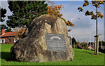 US RangersMemorial · 226 yd
 Carrickfergus MuseumMuseum · 287 yd
 St. Nicholas' Church of Ireland ChurchChurch · 317 yd
 Medieval Parish Church, Post-med. & Modern Church & Graveyard: St Nicholas' Church, St Nicholas of Cragfergus in CarrickfergusMedieval Parish Church, Post-med. & Modern Church & Graveyard: St Nicholas' Church, St Nicholas of Cragfergus · 321 ydFortified house built on franciscan friary: joymount in CarrickfergusFortified House built on Franciscan Friary: Joymount · 359 ydEnclosure in Carrickfergus; East Central WardEnclosure · 416 yd
 King William III MonumentMonument · 505 yd
 Battle of Carrickfergus (1760)Major battlefield · 545 yd
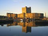 Carrickfergus CastleCastle · 548 yd
 Carrickfergus castle in CarrickfergusCarrickfergus Castle · 554 yd
More historic places in County Antrim · All of County Antrim
What do you know about this place?