What is recorded here
From OpenStreetMap (© OpenStreetMap contributors) n2018363307
Places near here
Photo credits
- Maker not stated on source page, www.pinterest.com
- Funnybone987, Wikimedia Commons · CC BY-SA 3.0
- Maker not stated on source page, en.wikipedia.org
- Maker not stated on source page, ca.pinterest.com
- Maker not stated on source page, za.pinterest.com
- N Chadwick, Wikimedia Commons · CC BY-SA 2.0
- N Chadwick, Geograph · CC BY-SA 2.0
- Maker not stated on source page, ayrshireandarran.com
- Killyhommon Primary School; photographer not named, www.killyhommonps.com
- Maker not stated on source page, www.tripadvisor.com.ph
 Two Standing StonesTwo Standing Stones, Megalithic Tomb? · 1453 yd
Explorer Tom Two Standing Stones, Megalithic Tomb? in Aghameelan is probably just two rocks that fell over and decided not to get up…
 Blackslee Waterfall WalkWalking route · 1.3 mi
Explorer Tom Blackslee Waterfall Walk has a legend that a giant once sneezed so hard he created the waterfall, then tried to blame…
 Carrick Church (Ruins)Ruins · 1.4 mi
Explorer Tom Carrick Church (Ruins) is proud of its lack of a roof because it gets excellent exposure to the elements. It’s…
 Church & Graveyard: Carrick or Aghamore Church in AghamoreChurch & Graveyard: Carrick or Aghamore Church · 1.4 mi
Explorer Tom Church & Graveyard: Carrick or Aghamore Church in Aghamore is playing hide-and-seek with me. A tale from 1846 says an…
 Blackslee waterfallWaterfall · 1.5 mi
Explorer Tom Blackslee waterfall was nearly sold to a farmer for a horse in 1920, but the water refused to be paid off. It’s still…
 Dry-stone structure, possibly sweat house in DromoreDry-stone Structure, possibly Sweat House · 1.8 mi
Explorer Tom Dry-stone structure, Possibly sweat house in Dromore nearly got famous when someone thought it was a UFO landing pad.…
 Old Man's HeadHeritage attraction · 1.9 mi
Explorer Tom Old Man's Head would handle a reality show like a pro, probably winning by doing absolutely nothing all day. He’s got…
 Cliffs of MaghoViewpoint · 2.0 mi
Explorer Tom The Cliffs of Magho lift a limestone brow above Lower Lough Erne, with islands scattered below like somebody emptied a…
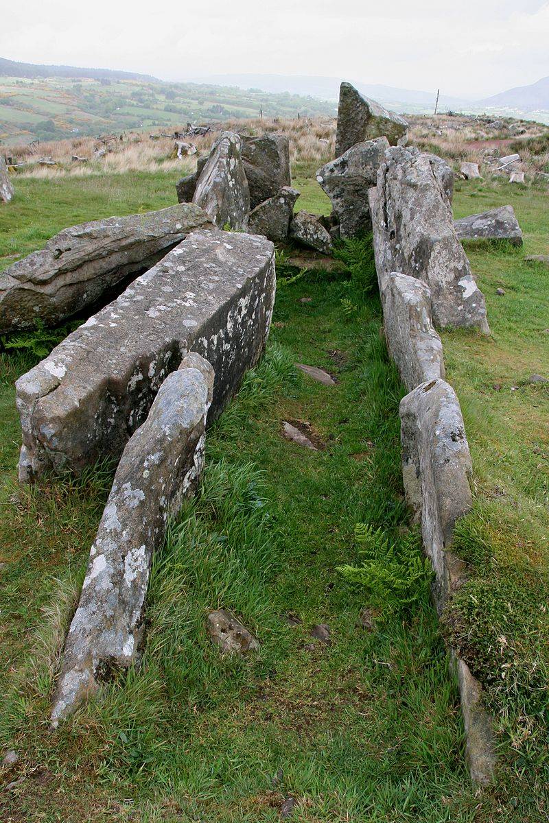 Booley hut: giants graveyard in Rossinure BegBooley Hut: Giants Graveyard · 2.6 mi
Explorer Tom Booley hut: giants graveyard in Rossinure Beg suggests the giants lived in tiny huts and complained about the drafts.…
 Court tomb: giant's grave in Rossinure BegCourt Tomb: Giant's Grave · 2.6 mi
Explorer Tom Court tomb: giant's grave in Rossinure Beg is hiding a treasure chest, but inside it’s just an empty biscuit tin and a…
 Canon Maguire ParkGAA ground · 2.7 mi
 Fortified house: tullykelter castle in TullykelterFortified House: Tullykelter Castle · 6.4 mi
Explorer Tom Fortified house: Tullykelter castle in Tullykelter would list 'emotionally available' on its dating profile, which is a…
More viewpoints and information in County Fermanagh · All of County Fermanagh

What do you know about this place?Tap to add a comment or ask a question