What is recorded here
Map note: Near Carnoustie, Angus, Scotland, the map records Carnoustie Rest Gardens as a park. See what else is around it before planning your day.
From OpenStreetMap (© OpenStreetMap contributors) w409863333
Places near here
Photo credits
- Peter O'Connor aka anemoneprojectors, Wikimedia Commons · CC BY-SA 2.0
- Maigheach-gheal, Wikimedia Commons · CC BY-SA 2.0
- Maker not stated on source page, commons.wikimedia.org
- JThomas, Wikimedia Commons · CC BY-SA 2.0
- Maker not stated on source page, www.tripadvisor.ca
- Maker not stated on source page, ru.pinterest.com
- Val Vannet, Wikimedia Commons · CC BY-SA 2.0
- Scott Cormie, Wikimedia Commons · CC BY-SA 2.0
- Ollie Lloyd, Wikimedia Commons · CC BY-SA 3.0
- Anne Burgess, Wikimedia Commons · CC BY-SA 2.0
- Douglas Nelson, Wikimedia Commons · CC BY-SA 2.0
- Richard Webb, Wikimedia Commons · CC BY-SA 2.0
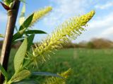 Dibble TreeCricket-bat willow · 166 yd
 The Dibble TreeVisitor information · 171 yd
 Carnoustie, High Street, Baptist ChurchChurch (20th Century) · 209 yd
 CarnoustieBurgh (medieval), Town · 213 yd
 Carnoustie, High Street, St Leonard's ChurchShop (20th Century), Tenement (19th Century) · 224 yd
 Carnoustie, Second Free ChurchCairn (early Bronze Age), Cist(s) (early Bronze Age) · 226 yd
 Carnoustie, High StreetLong Cist(s) (early Medieval) · 244 yd
 Carnoustie War MemorialMemorial · 260 yd
 Battle of BarryBattle · 350 yd
 Carnoustie BeachBeach / strand · 550 yd
Explorer Tom Carnoustie Beach sits below the town's famous golf links, a small sand-and-rock bay with a grand view across the Tay…
 Westhaven BeachBeach / strand · 1537 yd
 Shanwell CemeteryCemetery · 1.0 mi
More things to do in Angus · All of Angus

What do you know about this place?Tap to add a comment or ask a question