
What is recorded here
From OpenStreetMap (© OpenStreetMap contributors) n3807377179
Places near here
Photo credits
- David Dixon, Wikimedia Commons · CC BY-SA 2.0
- louise price, Geograph · CC BY-SA 2.0
- louise price, Wikimedia Commons · CC BY-SA 2.0
- National Inventory of Architectural Heritage
- Andreas F. Borchert, Wikimedia Commons · CC BY-SA 4.0
- Malene Thyssen, Wikimedia Commons · CC BY-SA 3.0
- Kenneth Allen, Geograph · CC BY-SA 2.0
- Kenneth Allen, Wikimedia Commons · CC BY-SA 2.0
 Rashenny PointHeadland · 1126 yd
Explorer Tom Rashenny Point thinks its secret talent is competitive napping, and honestly? It’s good at it. The headland is just vibing out there in the sun. Take the long way round, because this spot deserves the extra effort and scenic drive.
 Carntullagh HeadHeadland · 1393 yd
Explorer Tom Carntullagh Head is a rugged County Donegal point that apparently doubles as a fish farm. I imagine the wild seabirds looking down at their new plastic neighbours with mild confusion, wondering if this is still the natural order of things.
 Rotten IslandIslet · 1485 yd
Explorer Tom Rotten Island sounds like a pirate's insult, but its lighthouse story is serious. The light guides boats into Killybegs Harbour; three workers drowned returning from the island while it was being built. I would remember them whenever that white tower comes into view.
 Rotten Island LighthouseLighthouse keeper's house · 1498 yd
Explorer Tom Rotten Island Lighthouse keeper’s house is built to survive Atlantic storms, which makes me nervous just thinking about it. It’s robustly built with minimal detailing, but those eaves mouldings are doing their best, so grab a quick shot from the safety of the shore.
 Cat CastleCastle, tower house · 1731 yd
Explorer Tom Cat Castle is named after St. Catherine, but really it’s just a tiny stone corner standing on a hill above Killybegs Harbour. It’s been shrinking since 1355, and now only a 3-metre wall survives. It’s a bit pathetic, sure, but looking out over the harbour makes you wonder what that bishop’s manor looked like when it was whole.
 St Catherine's WellHoly well · 1756 yd
Explorer Tom St Catherine's Well in Killybegs was once a famous pilgrimage site, but there’s a daft legend that a Protestant rector tried to fill it up with dirt. The next day, a spring burst into his drawing room, terrifying his wife until he reopened the well. It’s still cleaned for St. Catherine’s Day, sitting beside the ruins of 'Cat Castle' in marshy pasture.
 St Catherine's Church and FriaryChurch · 1.0 mi
Explorer Tom St Catherine's Church and Friary may preserve an older friary in a church altered across several centuries. The survey found a tree growing through the north wall and dislodging much of a window. That tree took a route no mason planned.
 St Catherine's Friary GraveslabGraveslab · 1.1 mi
Explorer Tom St Catherine's Friary Graveslab marks John Lindsey, who died young at twenty-seven back in 1685. The slab is broken and its coat of arms has vanished, leaving just the incised Roman script to tell his story. It’s a bit sad that the family crest got lost, but the words remain.
 European Beech1.1 mi
Explorer Tom European Beech in County Donegal is just a tree, but a fancy one that thinks it runs the place. It’s probably been there longer than the local council has had a proper meeting. Perfect spot to practise your best tour-guide voice, say 'ahoy' and see if it flinches.
 Tara HotelHotel · 1.4 mi
Explorer Tom Tara Hotel in Killybegs is probably where some forgotten hero saved it from a tidal wave nobody else remembers. The Wi-Fi might be slow, but the stories fly faster than a gull on Main Street. Walk past slowly like you're in a film.
 Harbour BarPub · 1.4 mi
Explorer Tom Harbour Bar probably smells like old fish and bad decisions, because that’s what 'harbour' really means in this context. I’d grab a stool and listen to stories they don’t tell on TV. Ideal spot for a dramatic phone call.
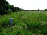 Killaghtee Old Church GraveyardGraveyard · 1.7 mi
Explorer Tom Killaghtee Old Church Graveyard sits beside the old church; inside the graveyard, southwest of that church, the survey records a cross-inscribed slab. The Civil Survey called the church 'in reparation', and it remained in use until 1826. I like how one small mapped area holds separate records for the graveyard, church and stone.
More mountains and hills in County Donegal · All of County Donegal

What do you know about this place?Tap to add a comment or ask a question