What is recorded here
The following description is derived from both the published 'Archaeological Inventory of County Louth' (Dublin: Stationery Office, 1986) and the 'Archaeological Survey of County Louth' (Dublin: Stationery Office, 1991). In certain instances the entries have been revised and updated in the light of recent research.
Date of upload/revision: 17 July 2007
Circular cairn situated on the summit of Carnawaddy (diam. c. 23m, max. H c. 4.7m). Traces of kerb remain from N-NE. Modern depression (diam. 1.2m, D 1.7m) in WSW of top of cairn. Stubbs (CLAJ 1909, 129) records a 'cave' in the cairn, but Tempest (CLAJ 1934, 191-2) suggests that it has not been opened. This is presumably a reference to a burial chamber which may have been uncovered during the disturbance noted on top of the cairn.
The monument record does not grant public access. Check the route and ask the landowner before entering private land.
- What survives
- Recorded monument
Places near here
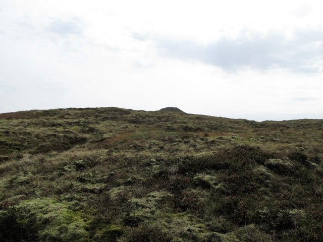 CarnavaddyMountain / peak · 8 yd
 Hut site in DoolargyHut site · 1573 yd
 Long Woman's GraveArchaeological place · 1.1 mi
 Enclosure in DoolargyEnclosure · 1.1 mi
 Cooley MountainsMountain range · 1.2 mi
 The Ben RockMountain / peak · 1.3 mi
 Caraban Househouse · 1.5 mi
 schoolschool · 1.5 mi
 Ravensdale ForestForest · 2.0 mi
 Ravensdale LoopWalking route · 2.1 mi
 Proleek DolmenArchaeological place · 2.6 mi
 CastleCastle, tower house · 3.1 mi