
Places near here
Photo credits
- National Inventory of Architectural Heritage
- Ben Brooksbank, Wikimedia Commons · CC BY-SA 2.0
- Malene Thyssen, Wikimedia Commons · CC BY-SA 3.0
- Ronnie Nijboer, Wikimedia Commons · CC0
- Kenneth Allen, Geograph · CC BY-SA 2.0
- Kenneth Allen, Wikimedia Commons · CC BY-SA 2.0
- Andreas F. Borchert, Wikimedia Commons · CC BY-SA 4.0
- David Dixon, Wikimedia Commons · CC BY-SA 2.0
- louise price, Wikimedia Commons · CC BY-SA 2.0
 bridge1125 yd
Explorer Tom Bridge in Ballyloughan carried the Donegal Town to Killybegs railway over the Oily River on three arches. Pointed cutwaters stand between them, while ivy now covers parts of the stone. With the rails gone, the river still gets its three doors.
 Church of SS Joseph & ConalChurch/chapel · 1272 yd
Explorer Tom Church of SS Joseph & Conal was built in 1913. I bet the old chapel that burned down right before it was so smoky, everyone sneezed their way out. Did anyone actually count how many crosses are hiding on those gables?
 European Beech1410 yd
Explorer Tom European Beech in County Donegal is a tree that pretends to be from somewhere warmer but lives here anyway. Vikings once got lost looking for it and ended up in a bog instead, which was definitely not their fault. Give it a respectful wave; don’t lean on it, it’s old and grumpy.
 Wych Elm1716 yd
Explorer Tom Wych Elm thinks tourists from Dublin have no idea what real nature is, judging them by their expensive hiking gear and bad puns. It pretends not to notice when they take selfies in front of it, but I’m sure it’s rolling its leaves. It’s got a bit of an attitude problem about authenticity. Bring your own legend, I've run out.
 Tara HotelHotel · 1.4 mi
Explorer Tom Tara Hotel in Killybegs is probably where some forgotten hero saved it from a tidal wave nobody else remembers. The Wi-Fi might be slow, but the stories fly faster than a gull on Main Street. Walk past slowly like you're in a film.
 MellysRestaurant · 1.4 mi
Explorer Tom Mellys serves fish and chips, which is basically a hug from the sea with a grudge against the rain. Wrap it tight so the salt doesn’t ruin your phone case. Stand back, squint, and it looks like a castle.
 Killaghtee Old Church GraveyardGraveyard · 1.6 mi
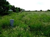
Explorer Tom Killaghtee Old Church Graveyard sits beside the old church; inside the graveyard, southwest of that church, the survey records a cross-inscribed slab. The Civil Survey called the church 'in reparation', and it remained in use until 1826. I like how one small mapped area holds separate records for the graveyard, church and stone.
 St Catherine's WellHoly well · 1.8 mi
Explorer Tom St Catherine's Well in Killybegs was once a famous pilgrimage site, but there’s a daft legend that a Protestant rector tried to fill it up with dirt. The next day, a spring burst into his drawing room, terrifying his wife until he reopened the well. It’s still cleaned for St. Catherine’s Day, sitting beside the ruins of 'Cat Castle' in marshy pasture.
 St Catherine's Friary GraveslabGraveslab · 1.8 mi
Explorer Tom St Catherine's Friary Graveslab marks John Lindsey, who died young at twenty-seven back in 1685. The slab is broken and its coat of arms has vanished, leaving just the incised Roman script to tell his story. It’s a bit sad that the family crest got lost, but the words remain.
 Cat CastleCastle, tower house · 1.8 mi
Explorer Tom Cat Castle is named after St. Catherine, but really it’s just a tiny stone corner standing on a hill above Killybegs Harbour. It’s been shrinking since 1355, and now only a 3-metre wall survives. It’s a bit pathetic, sure, but looking out over the harbour makes you wonder what that bishop’s manor looked like when it was whole.
 Rashenny PointHeadland · 2.0 mi
Explorer Tom Rashenny Point in County Donegal was once the prime spot for smuggling contraband teacups and very suspiciously large turnips right under the noses of the taxmen. The cliffs still look like they’re holding their breath, waiting for the next batch of illegal vegetables to arrive. Bring curiosity, leave with a better story than mine.
 Rotten IslandIslet · 2.4 mi
Explorer Tom Rotten Island sounds like a pirate's insult, but its lighthouse story is serious. The light guides boats into Killybegs Harbour; three workers drowned returning from the island while it was being built. I would remember them whenever that white tower comes into view.
More mountains and hills in County Donegal · All of County Donegal

What do you know about this place?Tap to add a comment or ask a question