
Places near here
Photo credits
- Britishfinance, Wikimedia Commons · CC BY-SA 4.0
- Espresso Addict, Geograph · CC BY-SA 2.0
- Espresso Addict, Wikimedia Commons · CC BY-SA 2.0
- Pam Brophy, Wikimedia Commons · CC BY-SA 2.0
- Graham Horn, Geograph · CC BY-SA 2.0
- Peter Gerken, Geograph · CC BY-SA 2.0
- Ian S, Wikimedia Commons · CC BY-SA 2.0
- Ben Gamble, Geograph · CC BY-SA 2.0
- National Inventory of Architectural Heritage
- Gillfoto, Wikimedia Commons · CC BY-SA 4.0
- bdolicki, Wikimedia Commons · CC BY-SA 3.0
- Maker named on the Wikimedia Commons picture page · Public domain
 MangertonMountain / peak · 971 yd
Explorer Tom Mangerton is the long-haired mountain, which is a rich joke from Kerry when the summit can be wrapped in cloud. At…
 Mangerton North TopMountain / peak · 1186 yd
Explorer Tom Mangerton North Top has a ghost living there who is too lazy to actually haunt anyone properly. He just sits on the…
 TooreencormickBattlefield · 1.7 mi
Explorer Tom Tooreencormick is playing hard to get, sitting on Mangerton like it’s keeping a secret from everyone. I hear a bishop…
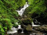 Torc WaterfallWaterfall · 1.9 mi
Explorer Tom If you hear a wild boar at Torc, check whether it is me puffing up the path. The name means boar, and the local tales…
 Muckross Lake WalkWalking route · 2.0 mi
Explorer Tom Muckross Lake Walk in County Kerry would teach history by making everyone stand in a puddle until they understood the…
 Castlelough BayBay · 3.8 mi
Explorer Tom Castellough Bay has a bird that refuses to leave no matter how much the wind tries to blow it away, and frankly, I envy…
 Cow IslandIsland · 3.9 mi
Explorer Tom Cow Island is probably having a secret party when nobody's looking, complete with bad music and damp grass. It’s got…
 Rough IslandIsland · 4.2 mi
Explorer Tom Rough Island is where a smuggler hid a crate of cheese that turned into a legend over time. Everyone swears they saw…
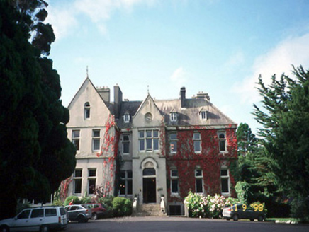 Cahernane HouseCountry house · 4.7 mi
Explorer Tom Cahernane House thinks it has an imaginary twin across the sea that looks exactly like it but wears better hats. The…
 Ross CastleHeritage attraction · 4.8 mi
Explorer Tom I would show up by boat, but Ross Castle knows that trick already. Ross Castle watches Lough Leane with the expression…
 Ross Castle (in ruins)Castle, tower house · 4.8 mi
Explorer Tom Ross Castle in County Kerry is moaning about damp to the council like it’s a grumpy old tenant. It’s perched on a rock…
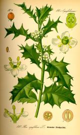 English holly5.0 mi
Explorer Tom English holly in County Kerry would complain to the council about the amount of bird droppings on its branches. It’s…
More archaeology and monuments in County Kerry · All of County Kerry

What do you know about this place?Tap to add a comment or ask a question