What is recorded here
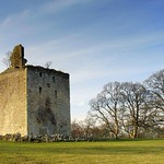
Carmunock, Busby Road is a historic event in Glasgow City, Scotland.
Places near here
Photo credits
- Stephen Sweeney, Wikimedia Commons · CC BY-SA 2.0
- Iain Thompson, Wikimedia Commons · CC BY-SA 2.0
- Richard Sutcliffe, Wikimedia Commons · CC BY-SA 2.0
- Maker not stated on source page, za.pinterest.com
- Maker not stated on source page, www.flickr.com
 Glasgow, Bankhead Road, GeneralGeneral View · 237 yd
 Carmunnock Parish Church, CarmunnockChurch, cross or graveyard · 298 yd
 Woodland by the Carmunnock BypassForest or wood · 332 yd
 Glasgow, Carmunnock, Pathhead Road, GeneralGeneral View · 407 yd
 Mapped cemeteryCemetery · 434 yd
 Glasgow, Kirk Road, Carmunnock Parish ChurchBurial Ground (post Medieval), Church (18th Century) (1762), Churchyard (post Medieval), Covenanters Grave (17th Century) (1691) · 448 yd
 Glasgow, 8 Busby RoadHouse (18th Century) · 479 yd
 Glasgow, Carmunnock, Waterside Road, Carmunnock Free ChurchChurch (late 19th Century) - (mid 20th Century), Hall (mid 20th Century) · 523 yd
 War MemorialMemorial · 559 yd
 Castle HillCastle (medieval) · 1326 yd
 Monteith WoodlandWood · 1.0 mi
 Remains of Mitchell Hill High Flats, CastlemilkMountain or hill · 1.1 mi
More wrecks and historic events in Glasgow City · All of Glasgow City

What do you know about this place?Tap to add a comment or ask a question