What is recorded here
Cap Cavall is a motor fishing vessel in Fife, Scotland.
From the Historic Environment Scotland record 322342
The historic-place record does not grant public access. Check current conditions and ownership before entering land or a building.
Places near here
Photo credits
- Anne Burgess, Wikimedia Commons · CC BY-SA 2.0
- Richard Webb, Wikimedia Commons · CC BY-SA 2.0
- Jerzy Morkis, Wikimedia Commons · CC BY-SA 2.0
- Unknown photographer, Wikimedia Commons · Public domain
- Colin Park, Wikimedia Commons · CC BY-SA 2.0
- Paul McIlroy, Wikimedia Commons · CC BY-SA 2.0
- William Starkey, Wikimedia Commons · CC BY-SA 2.0
- James Allan, Wikimedia Commons · CC BY-SA 2.0
- Richard Sutcliffe, Wikimedia Commons · CC BY-SA 2.0
- Aleks Scholz, Wikimedia Commons · CC BY-SA 2.0
 The Low LightVisitor information · 149 yd
 Isle of May, GeneralGeneral View · 178 yd
 Isle of May National Nature ReserveNature reserve · 217 yd
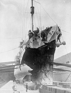 Battle of May IslandMaritime disaster · 301 yd
 Isle of May LighthouseLighthouse · 321 yd
 The Main LightVisitor information · 329 yd
 Jasper: Isle of May, North SeaSteamship (20th Century)-(1894) · 346 yd
 Isle of May, North NessCell(s), Pottery Scatter · 779 yd
 Victory: Norman Rock, North Ness, Isle of May, Firth of ForthSteam Trawler (20th Century) · 1018 yd
 Caiplie, 'the Coves'Cave(s), Hermitage (religious), Pictish Symbol Rock Carving(s) (pictish) · 5.2 mi
 Caiplie CavesHeritage attraction · 5.2 mi
 Crail CastleCastle (medieval), Chapel (medieval) · 5.5 mi
More wrecks and historic events in Fife · All of Fife
What do you know about this place?