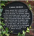
What is recorded here
This black commemorative plaque records: Canal Bridge - Canal Bridge was constructed in 1769. It has no towpath for security reasons to prevent public access. Boats were not allowed to moor inside the basin at night and at dusk a floating beam was locked into position on its North side. A toll house was built against the bridge wall on its North-Eastern side linked to the outhouse on the opposite bank by a swivel bridge Recorded plaque organisation: Coventry City Council.
From the Open Plaques record 54999
A plaque record does not grant entry to a building or private land. View it from a public place unless permission is clearly given.
Places near here
 Bridge 1, Drapers Fields BridgeCanal bridge · 1 ydCanal HouseListed building · 37 yd
 Canal WarehouseListed building · 89 yd
 Statue of James BrindleyMonument or public art · 116 yd
 Coventry BasinCanal basin · 122 yd
 Bishop GateArchaeological place · 247 yd
 Cook Street GateScheduled monument · 312 yd
 Coventry Transport MuseumMuseum · 377 yd
 Rail Trail: Coventry's Historic CentreWalking route · 734 yd
 Sir Thomas WhiteMemorial · 1151 yd
_was_educated_(geograph_6844690).jpg/250px-Plaque_commemorating_school_where_George_Eliot_(Mary_Ann_Evans)_was_educated_(geograph_6844690).jpg "Photo: A J Paxton, Wikimedia Commons · CC BY-SA 2.0") George Eliot PlaqueMemorial · 1234 yd
George Eliot PlaqueMemorial · 1234 yd Visitor Information1522 yd
Pictures: E Gammie, Wikimedia Commons · CC BY-SA 2.0; A J Paxton, Wikimedia Commons · CC BY-SA 2.0; Alan Hughes, Wikimedia Commons · CC BY-SA 2.0; Christine Johnstone, Wikimedia Commons · CC BY-SA 2.0; Philip Halling, Wikimedia Commons · CC BY-SA 2.0; David Dixon, Wikimedia Commons · CC BY-SA 2.0; Snowmanradio, Wikimedia Commons · CC BY-SA 3.0; Stephen Craven, Wikimedia Commons · CC BY-SA 2.0
What do you know about this place?