
Places near here
Photo credits
- Kenneth Allen, Geograph · Creative Commons Attribution-ShareAlike 2.0
- Richard Webb, Wikimedia Commons · CC BY-SA 2.0
- National Inventory of Architectural Heritage
- Kenneth Allen, Wikimedia Commons · CC BY-SA 2.0
- John M, Geograph · Creative Commons Attribution-ShareAlike 2.0
- John Darcy, Wikimedia Commons · CC BY-SA 2.0
- Rod Allday, Wikimedia Commons · CC BY-SA 2.0
- Michael Murtagh, Geograph · CC BY-SA 2.0
- Hollywelltrees, Wikimedia Commons · CC BY-SA 4.0
- Oliver Dixon, Geograph · CC BY-SA 2.0
- Dieglop, Wikimedia Commons · CC BY-SA 4.0
- Lucarelli, Wikimedia Commons · CC BY-SA 3.0
 Kilcoosey National SchoolSchool · 1.1 mi
 BenboMountain / peak · 1.6 mi
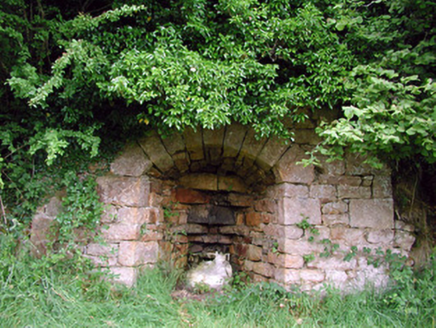 kiln2.7 mi
Explorer Tom The Kiln in Killarga suspects the postman is stealing lumps of lime for his garden. This industrial reminder keeps its original form and fabric intact, looking like a giant stone oven left on standby. Bring your own legend, I’ve run out of ideas.
 Manorhamilton CastleCastle · 3.2 mi
 IndicatedBastioned fort · 3.3 mi
Explorer Tom Manorhamilton’s bastioned fort claims its unlikely celebrity friend is a very serious statue of a general who never smiled. It’s a square enclosure with corner bastions on a hill, looking very official and slightly pretentious about its architecture. Sit on a wall near it and pretend you're in a painting.
 CastleCastle, tower house · 4.7 mi
Explorer Tom Castle in Kilmore would win the county fair for best dressed, even if it’s missing its hat. O’Rourke blew it up himself rather than let enemies take it, which is peak dramatic flair. Whisper a secret at it, it's kept worse.
 Parke's CastleVisitor attraction · 4.7 mi
 Keelogyboy Mountain ne TopMountain / peak · 5.6 mi
 Church IslandIslet · 7.1 mi
Explorer Tom Church Island has been asked if it actually has a church, and honestly, it’s gotten a bit fed up with the constant theological debate. It just wants to be left alone to rot in peace. Perfect detour when the satnav has a meltdown.
 Slishwood Island EastIslet · 7.3 mi
Explorer Tom Slishwood Island East is where a priest once lost a bet and has been sulking about it ever since, probably hiding in the trees. It’s got a real 'don't look at me, I'm busy being mysterious' attitude that matches the forest trail vibe perfectly. Stand on the spot and imagine the gossip it's heard.
 Glencar WaterfallVisitor information · 7.9 mi
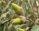 Holm Oak8.5 mi
Explorer Tom Holm Oak in County Sligo would win a county fair by simply standing there and looking superior to all the produce stalls. Its glossy leaves reflect the faces of everyone who dares challenge its beauty. Get a photo with it before it gets a better agent.
More archaeology and monuments in County Leitrim · All of County Leitrim

What do you know about this place?Tap to add a comment or ask a question