What is recorded here
Eight metres of limestone ridge break the pasture beside a ringfort, catching light on its NE slope while the Burren glimmers distant. The stones may have marked a buried chamber, a boundary, or a name forgotten before writing reached Clare. Whatever it recorded, the ridge still points inward, waiting for a hand to remember what it held.
In pasture, on top of a low rise with a distinct NE-facing slope, having moderate views of a gently undulating landscape and a distant Burren landscape on higher ground NE-S. Referred to locally as a possible cairn. It consists of a linear mound (L 8m NW-SE; Wth 3.5-5m NE-SW; H 0.8m) consisting of small and medium-sized limestones. It is very distinct in profile along its long axis and is sited on the highest point in the immediate vicinity. A ringfort (CL005-047----) is located c. 4m to NW.
The following images have been uploaded:
CL005-230----_01.jpg From SE. Cross section view across monument.
CL005-230----_02.jpg From SW. Long-axis/profile view of monument.
CL005-230----_03.jpg From ESE. General view of monument.
CL005-230----_04.jpg From NE. General view of monument.
Compiled by: Mary Tunney, Alison McQueen and Vera Rahilly
Date of upload: 18 December 2018
The monument record does not grant public access. Check the route and ask the landowner before entering private land.
- What survives
- Recorded monument
Places near here
 Enclosure in KnocknagroaghEnclosure · 194 yd
 OoanknocknagroaghFairy fort / stone ringfort · 308 yd
 Catholic Church of Saint John the Baptistchurch/chapel · 1352 yd
 Newtown CastleCastle, tower house · 1371 yd
 Bird Of Prey CentreHeritage attraction · 1479 yd
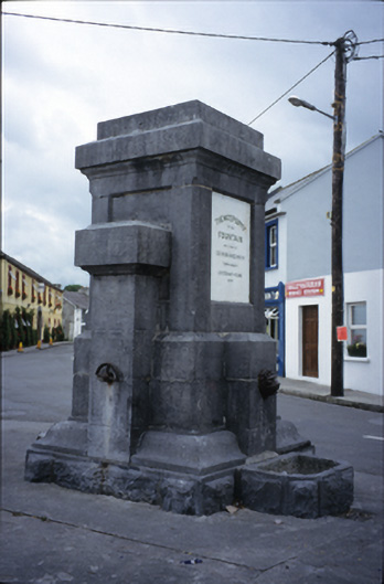 Ballyvaghan Fountainfountain · 1591 yd
 Aillwee CaveCave · 1737 yd
 Ballyvaghan Castle (in ruins)Castle, unclassified · 1.1 mi
 Rine PointHeadland · 2.1 mi
 CappanawallaMountain / peak · 2.3 mi
 Gleninshing portal tombHeritage attraction · 2.6 mi
 PoulnabroneMemorial · 3.7 mi