What is recorded here
Thirty years of rain and cattle trod the cairn at Drumacoo into a shallow grassy disc, yet the cross-base still stands at its north-west edge. The monastic complex gave up its shape slowly, losing one stone or shadow at a time while people kept passing within sight. What remains is small enough to walk around in a minute, but it belongs to a place where worship, memory and forgetting all happened together.
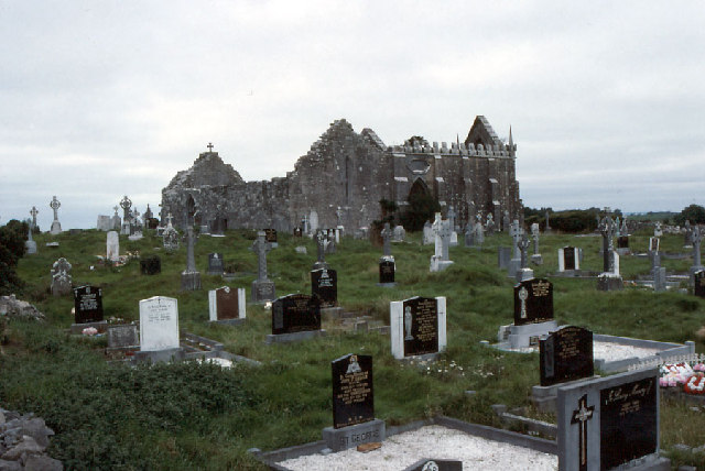
On a gentle SE-facing slope, c. 165m to the ESE of the church (GA103-118001-) at the monastic complex at Drumacoo. This poorly preserved subcircular cairn (13.5m NW-SE; 12.5m N-S; H < 2m) is defined by grassed-over stones. Field-clearance rubble has been dumped on its S half. A curving drystone wall surrounds the monument from SW to W. A cross-base and fragments of its shaft (see GA103-118008-), and a possible leacht (GA103-118013-) are visible at NW.
Compiled by: Galway Archaeological Survey, UCG
Date of upload: 15 December 2016
A Bronze Age cairn; its proximity to a monastic complex suggests possible later reuse or ritual continuity in the landscape.
The monument record does not grant public access. Check the route and ask the landowner before entering private land.
- What survives
- Recorded monument
Places near here
 Cross in DrumacooCross · 1 yd
 Drumacoo Monastic SiteHeritage attraction · 180 yd
 Drumacoomausoleum · 207 yd
 Newtown Ch.Church · 211 yd
 St. Sorneys WellHoly well · 261 yd
 Site of Kilcolgan CastleCastle, tower house · 1.1 mi
 MweenisharanIslet · 1.6 mi
 Ballynacourty Court (in ruins)Castle, hall-house · 2.4 mi
 Kilcornan ForestWood · 2.6 mi
 Fiddaun IslandIslet · 2.7 mi
 Loughaun WoodWood · 2.8 mi
 Mweenish PointHeadland · 2.8 mi