
Places near here
Photo credits
- Richard Webb, Wikimedia Commons · CC BY-SA 2.0
- Dorothy Carse, Wikimedia Commons · CC BY-SA 2.0
- Anne Burgess, Wikimedia Commons · CC BY-SA 2.0
- I A Smellie, Wikimedia Commons · CC BY-SA 2.0
- Iain Lees, Wikimedia Commons · CC BY-SA 2.0
- Antony Dixon, Wikimedia Commons · CC BY-SA 2.0
- Ann Harrison, Wikimedia Commons · CC BY-SA 2.0
 TombaeChapel (possible), Church (possible) · 1715 yd
 Allt DregnieBuilding · 1.0 mi
 AllanreidBuilding, Enclosure, Farmstead · 1.0 mi
 Nevie HillEnclosure, House(s) · 1.1 mi
 Bridge of TombaeBuilding · 1.3 mi
 Carn TullichMountain / peak · 1.3 mi
 AchdregnieFarmhouse, Farmstead · 1.4 mi
 Tombae, Roman Catholic Church of the IncarnationChurch (19th Century) · 1.4 mi
 Tombae, Roman Catholic Church, Chapel HousePresbytery (post Medieval) · 1.4 mi
 Tombae, Roman Catholic Church of the Incarnation, Burial GroundBurial Ground (19th Century) · 1.4 mi
 DelhandyEnclosure(s), House(s) · 1.5 mi
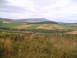 Battle of GlenlivetBattle · 1.8 mi
More mountains and hills in Moray · All of Moray

What do you know about this place?Tap to add a comment or ask a question