What is recorded here
Outleckan holds a prehistoric cairn in County Armagh, where uncertain dates and a formal map point disguise the hands that built it. Stones may have marked a tomb, a boundary or a warning, yet no written name survives to confirm the choice. The uncertainty does not weaken the place; it refuses a final answer and keeps the dead conversation open.
The official Northern Ireland record identifies this as CAIRN. Recorded period: UNCERTAIN; PREHISTORIC. The official map point was placed at the centre of the recorded archaeological site from the source map reference.
The monument record does not grant public access. Check the route and ask the landowner before entering private land.
- What survives
- Recorded monument
Places near here
 POST-MED CHURCH; GRAVEYARD: BALLYMOYER OLD CHURCH or LISDROMAUDE in BallintemplePOST-MED CHURCH; GRAVEYARD: BALLYMOYER OLD CHURCH or LISDROMAUDE · 1.5 mi
 St. Luke's ChurchChurch · 1.5 mi
 Lurgana HouseHouse · 1.9 mi
 Ballymoyer WoodWood · 1.9 mi
 Drumilly MountainMountain / peak · 2.5 mi
 ENCLOSURE in DrumcrowENCLOSURE · 2.5 mi
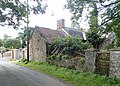 ENCLOSURE in Creggan UpperENCLOSURE · 2.6 mi
 Sugarloaf HillMountain / peak · 3.4 mi
 Tullyvallen Orange Hall massacremassacre · 4.2 mi
 Fews ForestForest · 4.2 mi
 BessbrookVisitor information · 4.9 mi
 War MemorialMonument · 5.0 mi