What is recorded here
Located on a ridge top known as 'Cairnhill' around which a housing estate has been built. A mound oval in plan of earthen construction with a flat-top. The mound is (L 13m; Wth 8m; H 2m) orientated NE-SW (Healy 1975, 1-19). Planted with mature beech and oak trees.
Located on a ridge top known as 'Cairnhill' around which a housing estate has been built. A mound oval in plan of earthen construction with a flat-top. The mound is (L 13m; Wth 8m; H 2m) orientated NE-SW (Healy 1975, 1-19). Planted with mature beech and oak trees.
From the National Monuments Service (Archaeological Survey of Ireland) record DU023-026
The monument record does not grant public access. Check the route and ask the landowner before entering private land.
- What survives
- Recorded monument
Places near here
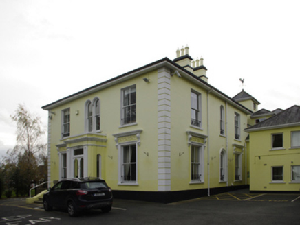 CairnhillHouse · 63 yd
 Cornelscourt HouseHouse · 85 ydCornelscourtCastle, tower house · 480 ydCist in DeansgrangeCist · 611 ydCastleCastle, unclassified · 848 ydWelcome to FoxrockVisitor information · 1046 yd
 Foxrock Village Heritage MapVisitor information · 1081 ydSamuel BeckettMemorial · 1097 ydBrian NolanHeritage attraction · 1154 ydThomas Joseph Smith (Sudocrem)Heritage attraction · 1268 yd
 Grange ChurchEcclesiastical site · 1455 yd
 Proclamation of the Irish RepublicMemorial · 1584 yd
Pictures: National Inventory of Architectural Heritage; Sarah777, Geograph · CC BY-SA 2.0; Kania1966, Wikimedia Commons · CC BY-SA 4.0; Patrick Keegan, Wikimedia Commons · CC BY 4.0
More archaeology and monuments in County Dublin · All of County Dublin
What do you know about this place?