
Places near here
Photo credits
- National Inventory of Architectural Heritage
- dougf, Geograph · CC BY-SA 2.0
- Rryswny, Wikimedia Commons · CC BY-SA 4.0
- Andreas F. Borchert, Wikimedia Commons · CC BY-SA 4.0
- Stephan van Helden, Wikimedia Commons · CC BY-SA 4.0
- Graham Horn, Geograph · CC BY-SA 2.0
- Ingo Mehling, Wikimedia Commons · CC BY-SA 3.0
- Malene Thyssen, Wikimedia Commons · CC BY-SA 3.0
- DeeEmm, Wikimedia Commons · CC BY-SA 2.0
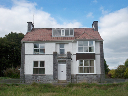 Mellows CampusBuilding misc · 506 yd
Explorer Tom Mellows Campus in Ballygarraun West is hiding a secret tunnel to the pub that only works if you whisper the right rhyme. It’s been seized by rebels before, but mostly it just steals your homework. Tell the bay window Tom says it’s got more secrets than a nun.
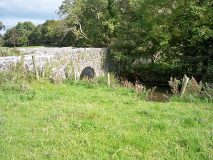 bridge1071 yd
Explorer Tom Bridge in Cloran would tell Saint Patrick to stop poking his nose around here. The approach walls build up anticipation like a really bad pun. Stand back, so you don’t trip over your own feet.
 Derrydonnell Castle (in ruins)Castle, tower house · 1.7 mi
Explorer Tom Derrydonnell Castle is hiding a treasure that is definitely just a biscuit tin from 1982, but keep looking because it might be gold. The tower has seen more drama than your family Christmas. Go now, before it gets famous.
 IndicatedTown defences · 1.8 mi
Explorer Tom Town defences in Athenry are just the bones of what used to keep people out or in. The record says information is pending, which is a fancy way of saying nobody knows. Linger, it's not going anywhere and neither should you.
 Check mapCross, Market cross · 1.9 mi
Explorer Tom Check map in Athenry is actually a late fifteenth-century market cross in the town square. It’s been watching people haggle for centuries while pretending it doesn’t care about prices. Pretend it's yours and plan the housewarming party with local vendors.
 Athenry AbbeyHeritage attraction · 1.9 mi
Explorer Tom Athenry Abbey in County Galway was built by a giant who just wanted somewhere to store his extra socks. The monks were too polite to ask him to move out later. Have a nosey, politely.
 Horse-chestnut1.9 mi
Explorer Tom Horse-chestnut in County Galway ended up here because someone planted the wrong seed and then just left it alone for a century. It’s confused about its identity, so look for the ghost that supposedly haunts its branches, then pretend you didn't see anything at all.
 Athenry CastleHeritage attraction · 2.0 mi
Explorer Tom Athenry Castle in County Galway is the favorite gossip spot for the local seagulls, who complain about the fish supply daily. They’ve been doing this since before your grandparents were born. Best visited with a curious kid and no timetable.
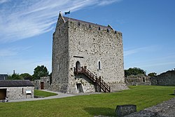 Castle or King Johns Court (in ruins)Castle, Anglo-Norman masonry castle · 2.0 mi
Explorer Tom Castle or King Johns Court in Athenry, County Galway was built by Meiler de Bermingham around 1235, but I suspect King John just used it for his afternoon tea. It controls a ford over the River Clareen. Bring the dog, it'll have opinions.
First Battle of AthenryBattle · 2.3 miExplorer Tom The First Battle of Athenry involved a cow that tried to buy its way out with milk. History is mostly made up by people who were hungry. Pick a stone, any stone, and invent its biography.
 European Beech7.6 mi
Explorer Tom This European Beech in County Galway would order a triple chip with mushy peas and ketchup at a chippy, purely for the salt content. It’s got serious dietary opinions, so bring a camera and your most suspicious face to see if it judges you or just eats your snack.
 Knocktuagh alias Knockdoe ...Battlefield · 8.0 mi
Explorer Tom Knocktuagh alias Knockdoe in County Galway claims it’s actually older than the concept of time itself, which is a bold move for a hill with a circular mound. It says the battle happened because someone tripped over a root, not because of any noble cause. Find the date carved somewhere and feel clever; you’ll probably be wrong.
More archaeology and monuments in County Galway · All of County Galway

What do you know about this place?Tap to add a comment or ask a question