What is recorded here
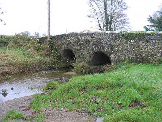
Two-arch rubble stone road bridge over river, c.1750. Random rubble stone walls with cut-limestone triangular cut-water to pier having rendered coping, and painted rendered coping to parapets. Pair of round arches with rubble limestone voussoirs, and rendered soffits. Sited spanning tributary of Kings River with grass banks to river.
Exhibiting a traditional construction in unrefined locally-sourced stone a small-scale bridge representing an important element of the mid eighteenth-century civil engineering heritage of County Kilkenny makes a pleasing visual impression in a rural setting.
This does not grant access. Most recorded buildings are privately owned; view them only from public ground unless the owner allows entry.
Places near here
 White ChurchArchaeological place · 273 yd
 Grave YardGraveyard · 279 yd
 BawnwilliamForest · 540 yd
 Wellington Ho.Castle, unclassified · 621 yd
 Sally OsiersForest · 651 yd
 Loughbrack Church (Ballytobin)church/chapel · 1002 yd
 Ballaghtobinhouse · 1470 yd
 TowerHouse, fortified house · 1.4 mi
 Mill IslandIslet · 1.6 mi
 Pat WalshMemorial · 2.1 mi
 Coolaghmore National SchoolMemorial · 2.2 mi
 Green StreetVisitor information · 2.7 mi
Other information
Photo: National Inventory of Architectural Heritage · Website use allowed for educational or private purposes with source credit