
What is recorded here
From OpenStreetMap (© OpenStreetMap contributors) w317219212
Places near here
Photo credits
- National Inventory of Architectural Heritage
- Eddylandzaat, Wikimedia Commons · CC BY 3.0
- GenesisNZ, Wikimedia Commons · CC BY-SA 4.0
- Chris, Geograph · CC BY-SA 2.0
- Roger Diel, Geograph · CC BY-SA 2.0
- Simon Huguet, Wikimedia Commons · CC BY-SA 2.0
- Gordon Hatton, Geograph · CC BY-SA 2.0
- Roger Diel, Wikimedia Commons · CC BY-SA 2.0
- Richard cattel, Geograph · CC BY-SA 2.0
- nick macneill, Geograph · CC BY-SA 2.0
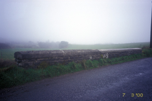 Doonsallagh BridgeBridge · 471 yd
Explorer Tom Doonsallagh Bridge is a single arch that thinks it’s a giant because of a local legend nobody believes. Have a nosey at the benchmark, politely, and try not to feel small next to its ambition.
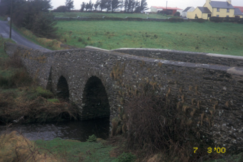 Aghy BridgeBridge · 1.4 mi
Explorer Tom Aghy Bridge in Kildeema South has two arches and has survived storms since around 1800 without even flinching. It’s just sitting there over the river, pretending it didn’t see that tree fall last week. Stop the car, it's worth the hazard lights.
 SlievecallanMountain / peak · 3.2 mi
Explorer Tom Slievecallan, a mountain that’s as rugged as the winter landscape it’s dressed in during January.
 Spanish Point BeachBeach / strand · 3.7 mi
Explorer Tom Spanish Point Beach is an extensive sandy stretch west of Milltown Malbay, though you’ll need to watch the bye-laws.
 Spanish PointVisitor information · 3.7 mi
Explorer Tom Spanish Point has me wondering if it's a place where the Spanish Armada once landed; the account doesn't say what's special about it.
 Caherrush Castle (in Ruins)Castle, tower house · 4.5 mi
Explorer Tom Caherrush Castle is probably being run by a fox who thinks he’s the landlord. It’s a tower house that’s seen better days and worse tenants. Pick a stone, any stone, and invent its biography as a famous pirate.
 Emlagh PointHeadland · 4.6 mi
Explorer Tom Emlagh Point is a headland in County Clare, perhaps offering a panoramic view of the bay and the western coastline ahead.
 Cream PointHeadland · 4.7 mi
Explorer Tom Cream Point is a headland in County Clare, maybe named for its pale stone contrasting sharply with the dark ocean water.
 Freagh IslandIslet · 5.0 mi
Explorer Tom Freagh Island, you're a tiny gem that only shows up at low tide. I bet the waves are always trying to stop you.
 Moy CastleRuins · 5.0 mi
Explorer Tom Moy Castle is a recorded ruin in County Clare, looking quite mysterious and full of potential for cheeky imagination.
 Seafield North BeachBeach / strand · 5.9 mi
Explorer Tom Seafield North Beach gives views of Seafield harbour and Mutton Island in the distance, perfect for a wander.
 Lahinch BeachBeach / strand · 7.4 mi
Explorer Tom Lahinch Beach lies near Lehinch, offering a classic Irish coastal scene that has captured many photographers’ hearts.
More archaeology and monuments in County Clare · All of County Clare

What do you know about this place?Tap to add a comment or ask a question