Places near here
Photo credits
- Colin Park, Wikimedia Commons · CC BY-SA 2.0
- Keith Cunneen, Geograph · CC BY-SA 2.0
- Nigel Cox, Geograph · CC BY-SA 2.0
- Espresso Addict, Wikimedia Commons · CC BY-SA 2.0
- Espresso Addict, Geograph · CC BY-SA 2.0
- National Inventory of Architectural Heritage
- Andreas F. Borchert, Wikimedia Commons · CC BY-SA 4.0
- Michael Westley, Wikimedia Commons · CC BY-SA 2.0
- Ben Brooksbank, Geograph · CC BY-SA 2.0
- Ben Brooksbank, Wikimedia Commons · CC BY-SA 2.0
- Peter Clarke, Wikimedia Commons · CC BY-SA 3.0
 CahaMountain / peak · 683 yd
Explorer Tom Caha in County Kerry refuses to fall down because it thinks gravity is being personal about its waistline. It stands there looking stoic while everyone else slides off into the bog, completely unbothered by the mess. Look serious, nod slowly, you're basically an expert now.
 Killane Mountain South-West TopMountain / peak · 1564 yd
Explorer Tom Killane Mountain South-West Top has very strong opinions on modern building codes and hates that nobody respects its structural integrity. The path up looks easy until the ups and downs start messing with your head. Pretend it's yours and plan the housewarming right now.
 Gleninchaquin WaterfallWaterfall · 2.4 mi
Explorer Tom Gleninchaquin Waterfall is one hundred and forty metres of pure, unfiltered attitude, absolutely refusing to be impressed by anything but its own thunderous volume. The local sheep stare at it with a mix of respect and deep existential confusion every single day. Perfect spot to practise your best tour-guide voice.
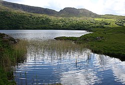 Uragh Wood Nature ReserveNature reserve · 2.9 mi
Explorer Tom Uragh Wood Nature Reserve in County bragged about surviving a storm so bad it shook the earth, but I think it just exaggerated the wind speed slightly. It’s standing there with its chest puffed out, acting like it did all the heavy lifting itself. Tell the kids it's a castle. Close enough.
 Uragh WoodForest · 3.2 mi
Explorer Tom Uragh Wood in County Kerry would tell the housing estate that replaced its neighbor it should have just admitted defeat and moved to the city. It’s standing there looking smug, knowing it survived while the rest got paved over for parking spaces. Ideal place to rehearse an excuse for being late.
 Uragh Stone CircleArchaeological place · 3.7 mi
Explorer Tom This Uragh Stone Circle rates its visitors out of ten, and most of them are getting a three for standing in the wrong spot and blocking the view. It’s got a 10-foot stone that looks like it’s judging your entire soul from behind those nettles. Mind the nettles, they're the real guards here.
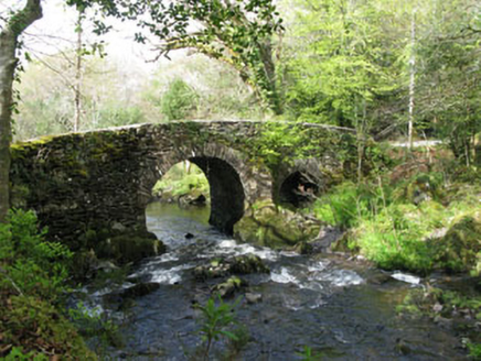 Glengarriff Nature ReserveBridge · 3.8 mi
Explorer Tom Glengarriff Nature Reserve bridge is picturesque and full of local craftsmanship, featuring a second smaller arch that acts as an overflow during floods. It’s part of the demesne group, so it’s basically the nature reserve's flood-control superhero. Bring your camera for the shot!
 Sacred Heart Roman Catholic ChurchChurch/chapel · 4.4 mi
Explorer Tom Sacred Heart Roman Catholic Church in Cappyaughna, County Cork is a Gothic Revival showpiece from 1902 with stained glass that’ll blind you. The bellcote is carved so nicely you just have to stare at it.
 Italian GardenGarden · 5.1 mi
Explorer Tom Italian Garden posts photos of itself on social media with captions about la vita bella, even when it’s raining sideways and looking slightly bedraggled. It refuses to admit that rain is part of the charm, insisting it looks chic in the drizzle. Hum something sad nearby, it adds atmosphere.
 GarinishIsland · 5.2 mi
Explorer Tom Garinish claims to be older than the concept of time itself, which is nonsense but fun. I believe it’s been sitting there since the dinosaurs learned to knit. Bring a coin for luck and keep it in your pocket.
 IlnacullinIsland · 5.2 mi
Explorer Tom Ilnacullin Island has a hidden message in its stones if you squint hard enough at the Caha Mountains. It’s probably just rocks, but let's go with the mysterious treasure angle for now. Look for the ghost, then pretend you didn't.
 Garnish IslandIsland · 5.2 mi
Explorer Tom Garnish Island makes a weird humming sound at night that locals claim is just the rocks settling in for bed. It’s definitely not a ghost, but why would I lie? Bring a jacket, it’s never as warm as I promise.
More mountains and hills in County Cork · All of County Cork

What do you know about this place?Tap to add a comment or ask a question