What is recorded here
One of three burnt mounds identified during the monitoring of topsoil-stripping for the N7 Nenagh Bypass. Located a few metres E of Site B, this mound, Site C (diam. 12m x 12.5m E-W; D c.0.3m) revealed multi-phase activity. Three-quarters of the site was excavated and the remainder preserved. The primary phase consisted of a number of clay-lined pits and associated stake-holes and bone and wood remains, all of which was sealed by a number of cobbled surfaces. On the highest part of the site there was a flour-post rectangular structure with two clay-lined troughs nearby. This phase was sealed by a low, charcoal-rich burnt stone mound. (O'Brien 2000, 290).
Compiled by: Caimin O'Brien.
Date of upload: 22 September 2008
Burnt mound (fulacht fiadh), likely dating to the Bronze Age. These sites are significant as they provide insight into prehistoric cooking, ritual, or industrial activities.
The monument record does not grant public access. Check the route and ask the landowner before entering private land.
- What survives
- Recorded monument
Places near here
 Ballycahill Church (site of)Church · 432 yd
 Ballycahill Castle (in ruins)Castle, unclassified · 526 yd
 ShannacloghRuins · 676 yd
 Patricks WellHoly well · 730 yd
 CastleCastle, motte and bailey · 742 yd
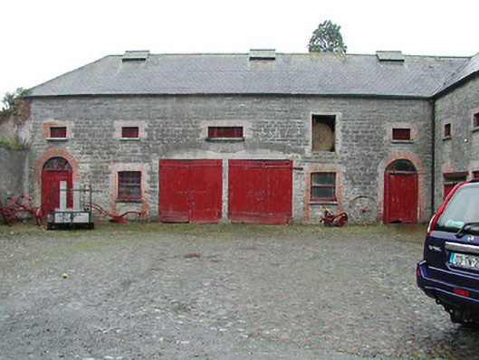 Solsborough Houseoutbuilding · 1.3 mi
 Nenagh Heritage CentreMuseum · 2.1 mi
 Old BarracksHeritage attraction · 2.3 mi
 Gibbet HillMountain / peak · 3.3 mi
 Sweet ChestnutSweet Chestnut · 3.5 mi
 The MinerMemorial · 3.5 mi
 Our Lady Assumed into HeavenMemorial · 3.5 mi