What is recorded here
In wet pasture 225m E of the townland boundary with Newtown. Earthwork (LI049-049002-) lies 40m to NE. Not depicted on the OSi historic maps. Identified by Tracy Collins during archaeological testing (license 06E0226) undertaken in advance of house construction, the results of which were summarised as follows; ‘Testing was undertaken in advance of the construction of two dwellings and ancillary groundworks. Four trenches were excavated across the footprint of the proposed development. Trench 4 revealed evidence of a burnt mound interpreted as a fulacht fiadh, measuring 11m north-east/south-west and 6m in width. It was agreed that the house impacting on the burnt mound could be moved in order to preserve the archaeological feature in situ. The new house location was then tested with three trenches. Nothing of an archaeological nature was found there’ (www.excavations.ie; Duntryleague, Limerick, No. 1260). No surface trace visible on Google Earth orthoimages.
See attached location map taken from excavation report.
Compiled by: Martin Fitzpatrick
Date of upload: 5 October 2021
A burnt mound; date and cultural context uncertain, but likely Bronze Age. Such features are commonly associated with ritual or industrial activities, though their exact function remains debated.
The monument record does not grant public access. Check the route and ask the landowner before entering private land.
- What survives
- Recorded monument
Places near here
 Field system in DuntryleagueField system · 206 yd
 BarrowBarrow, ditch barrow · 676 yd
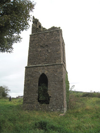 Duntryleague Church (Galbally)church/chapel · 1369 yd
 Duntryleague - hachuredCastle, ringwork · 1391 yd
 Aughavoona Househouse · 1580 yd
 Ryves CastleCastle, unclassified · 1620 yd
 Saint Patrick's WellSpring · 1.2 mi
 Darby's Bed Walk LoopWalking route · 1.4 mi
 Duntryleague HillMountain / peak · 1.5 mi
 Carn (site of)Cairn, burial cairn · 1.8 mi
 St Patrick's WellSpring · 2.4 mi
 SlievereaghMountain / peak · 3.0 mi