
What is recorded here
From the National Monuments Service (Archaeological Survey of Ireland) record RO048-190
Places near here
Photo credits
- Maker not stated on source page, www.tripadvisor.ie
- Maker not stated on source page, fi.pinterest.com
- Maker not stated on source page, www.roscommonherald.ie
- Maker not stated on source page, www.geograph.ie
- Graham Horn, Geograph · CC BY-SA 2.0
- Maker not stated on source page, irishheritagenews.ie
- Maker not stated on source page, www.thejournal.ie
- Maker not stated on source page, www.tripadvisor.in
- Maker not stated on source page, storage.googleapis.com
- Maker not stated on source page, commons.wikimedia.org
- Maker not stated on source page, www.wikidata.org
 CastleCastle, unclassified · 1575 yd
Explorer Tom Castle in Kilcar would describe itself as 'vintage' but honestly, it’s more like 'missing in action.' A map from 1636…
 Mapped cemeteryCemetery · 1.3 mi
Explorer Tom Right next to this Mapped Cemetery in Roscommon, there was a love story that ended with someone throwing a shoe at a…
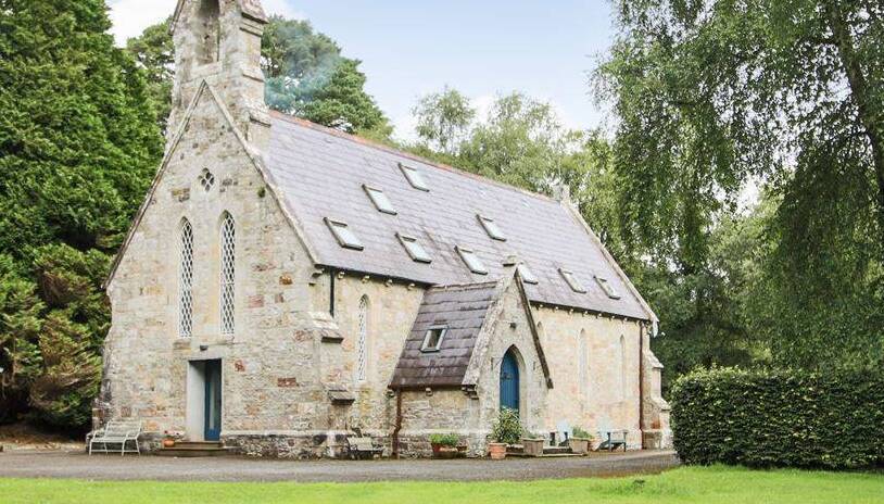 Church in BrideswellChurch · 1.4 mi
Explorer Tom Church in Brideswell would post on social media about how it used to be cool before everyone forgot where it was. It’s…
 Graveyard in BrideswellGraveyard · 1.4 mi
Explorer Tom Graveyard in Brideswell was the site of a massive feud between two families over who owned the best view of the river.…
 Cam Church (in Ruins)Church · 1.4 mi
Explorer Tom Cam Church smells like old stone and regret, according to Tom, which is basically the scent of history doing its thing.…
 Fairy fort / earthen ringfort in CornageehaFairy fort / earthen ringfort · 1.6 mi
Explorer Tom Fairy fort / earthen ringfort in Cornageeha gave up chocolate for Lent but kept the mud, which shows true commitment to…
 Fairy fort / stone ringfort in FeacleFairy fort / stone ringfort · 2.1 mi
Explorer Tom Fairy fort / stone ringfort in Feacle is a D-shaped feature that only shows up on aerial photos because it’s too shy to…
 Castle NaghtanCastle, unclassified · 2.3 mi
Explorer Tom Castle Naghtan thinks it's a dating agency because someone got married here in the sixteenth century and hasn't stopped…
 Fairy fort / stone ringfort in CloonacaltryFairy fort / stone ringfort · 2.4 mi
Explorer Tom Fairy fort / stone ringfort in Cloonacaltry thinks the road leading to it is an insult because it’s paved while this…
 Earthwork in SkeavallyEarthwork · 3.0 mi
Explorer Tom Earthwork in Skeavally does all sorts when nobody's looking, probably rearranging its own stone facing just to see if…
 Fairy fort / earthen ringfort in Gortaphuill (athlone North By.)Fairy fort / earthen ringfort · 3.2 mi
Explorer Tom Fairy fort / earthen ringfort in Gortaphuill, County Roscommon is basically a rabbit hotel with a field bank running…
 Fairy fort / earthen ringfort in TullyneenyFairy fort / earthen ringfort · 3.4 mi
Explorer Tom Fairy fort or earthen ringfort in Tullyneeny has made a New Year's resolution to finally fix that farm track cutting…
More archaeology and monuments in County Roscommon · All of County Roscommon

What do you know about this place?Tap to add a comment or ask a question