What is recorded here
No visible chamber connects the two rows, yet the gap between them is the smallest possible distance across which the dead can still be reached. The living row faces the sea and the dead row faces the land, not each other, because the gap is the relationship and the stones are only its witnesses.
In rough pasture, in a hollow which slopes down to the W to the edge of a rocky inlet in Baltimore harbour. Known locally as a burial place, this roughly oval or boat-shaped area (c. 15m E-W; c. 4m N-S), overgrown with ferns, is defined by 29 upright stone slabs and by six recumbent stones. The N side is comprised of 13 stones (max. L 1.12m; max. H 0.7m) while the S side has 22 stones (max. L 1.19m; max. H 0.65m). Three stone slabs (H 0.5m), aligned N-S, stand in the western third of the interior and may be grave-markers. The ground slopes up from the exterior of the N side and slopes down from the S side. (Snodgrass 2004, 109-12).
The above description is derived from 'The Archaeological Inventory of County Cork. Volume 5' (Dublin: Stationery Office, 2009).
Date of upload: 22 December 2009
The monument record does not grant public access. Check the route and ask the landowner before entering private land.
- What survives
- Recorded monument
Places near here
 Quay in BaltimoreQuay · 167 yd
 RoadRoad, road/trackway · 179 yd
 boathouseboathouse · 634 yd
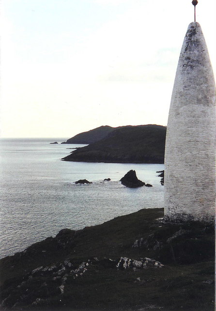 The Beaconbeacon · 700 yd
 Beacon PointViewpoint · 701 yd
 Baltimore BeaconNavigational beacon · 787 yd
 ToberanargidHoly well · 909 yd
 Dún na Station castleCastle · 1020 yd
 Bawn in BaltimoreBawn · 1028 yd
 Spanish IslandIsland · 1.0 mi
 Jeremiah's IslandIslet · 1.3 mi
 Cow StrandBeach / strand · 1.7 mi
Other information
Photo: Credit not shown in the picture search · Rights wording not checked; contact us if this picture should be removed