What is recorded here
On the N summit of a N-S ridge which is the highest point for some distance with very good views in all directions. The manor of Buolick was held by Mannaseur Arsic in 1200 and in 1307 by John Assyk. The ringwork consists of a high central mound enclosed by a bank (Wth 6.5m; int. H 1.68m; ext. H 5.5m), with a deep…
Read the whole record
From the National Monuments Service (Archaeological Survey of Ireland) record TS048-020003
Places near here
Photo credits
- Maker not stated on source page, uk.pinterest.com
- Maker not stated on source page, ru.pinterest.com
- National Inventory of Architectural Heritage
- Mike Searle, Geograph · CC BY-SA 2.0
- Maker not stated on source page, www.flickr.com
- Maker not stated on source page, en.wikipedia.org
- Edvardforeve, Wikimedia Commons · CC BY-SA 4.0
- A.-K. D., Wikimedia Commons · CC BY-SA 4.0
- Maker not stated on source page, www.pinterest.com
- Maker not stated on source page, www.dreamstime.com
 Castle (in ruins)Castle, tower house · 232 yd
Explorer Tom The Buolick tower house would handle a nosey neighbour by just pretending not to be there anymore. It was built in 1452…
 Buolick Church RuinArchaeological place · 421 yd
Explorer Tom Buolick Church Ruin is the victim of a bad poem someone wrote about it in 1994, and it has never really recovered from…
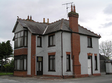 presbytery/parochial/curate's house1069 yd
Explorer Tom Presbytery in Gortnahoo was once ruled by a goat who wore the rector's hat and ate the parish records. Now it just…
 Littlefield HouseCountry house · 1.1 mi
Explorer Tom Littlefield House in Littlefield caused such a huge parish argument that it lost its roof and still doesn't care. It’s…
 Clonamicklon Castle (in ruins)House, fortified house · 1.1 mi
Explorer Tom Clonamicklon Castle in Clonamicklon is a fortified house that seems to be hiding from its own fame. John Butler built…
Clonamicklon Castle (ruins)Castle · 1.2 miExplorer Tom Clonamicklon Castle gave up meat for Lent but accidentally ate a whole sheep during the Easter party. It’s trying to…
 Church in KilbraughChurch · 1.9 mi
Explorer Tom Church in Kilbraugh has been hiding a scandal for centuries that involves someone stealing the roof tiles and selling…
 Kilcooly AbbeyHeritage attraction · 1.9 mi
Explorer Tom Kilcooly Abbey has a roof over the nave and sky over nearly everything else, as if the Cistercians could never agree on…
 Kilcooly Abbey (in ruins)Religious house, Cistercian monks · 1.9 mi
Explorer Tom Kilcooly Abbey in Kilcoolyabbey is mostly gone now, leaving just a column that looks half-concrete and very confused…
 Font in KilcoolyabbeyFont · 1.9 mi
Explorer Tom Font in Kilcoolyabbey is guarding a hidden treasure that is definitely just a biscuit tin left behind by a very hungry…
 Two Mile Borris CemeteryCemetery · 4.4 mi
Explorer Tom Two Mile Borris Cemetery in County Tipperary would explain the 1800s to a teenager as the era before everyone stopped…
 Lanespark GraveyardGraveyard · 5.0 mi
Explorer Tom Lanespark Graveyard makes a low humming sound at night that sounds suspiciously like someone trying to remember the…
More castles and forts in County Tipperary · All of County Tipperary

What do you know about this place?Tap to add a comment or ask a question