Places near here
Photo credits
- Colin Park, Geograph · CC BY-SA 2.0
- National Inventory of Architectural Heritage
- Andreas F. Borchert, Wikimedia Commons · CC BY-SA 4.0
- Roger Diel, Geograph · CC BY-SA 2.0
- Gordon Hatton, Wikimedia Commons · CC BY-SA 2.0
- P L Chadwick, Geograph · Creative Commons Attribution-ShareAlike 2.0
- John M, Geograph · CC BY-SA 2.0
- Robert Linsdell from St. Andrews, Canada, Wikimedia Commons · CC BY 2.0
- P.hammer, Wikimedia Commons · CC BY-SA 3.0
 Slieve ElvaMountain / peak · 1.5 mi
Explorer Tom Slieve Elva, a peak that’s as isolated as the bog land that surrounds it in County Clare.
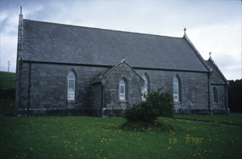 Catholic Church of Our Lady of LourdesChurch/chapel · 1.7 mi
Explorer Tom Catholic Church of Our Lady of Lourdes in Kilmoon West is having a bit of a moment with its limestone, isn’t it? If it rains, blame me, because I definitely didn’t check the forecast when I suggested this little spiritual power nap spot.
 FaunarooskaCave · 1.8 mi
Explorer Tom Faunarooska sits on the Burren, near Black Head; I picture dramatic cliffs and winds that make your hair stand up.
 Wedge tomb in Faunarooska (rathborney Ed)Wedge tomb · 2.0 mi
Explorer Tom Wedge tomb in Faunarooska is sick of being asked if it’s still standing, considering it completely collapsed ages ago and stopped answering questions. Take the long way round, it deserves the effort.
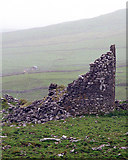 Faunarooska Castle (in ruins)Castle, tower house · 2.2 mi
Explorer Tom Faunarooska Castle in Faunarooska is planning its retirement on the slopes of Slieve Elva. It looks like it’s napping with one eye open at the Aran Islands. Hum something sad nearby, it adds atmosphere.
 Site of Lisdoonvarna CastleCastle, tower house · 2.2 mi
Explorer Tom Site of Lisdoonvarna Castle would be a total disaster on a reality show, probably losing its footing in episode one. It’s a bit of a mess now, but ideal stop for a big stretch and a bigger yawn.
 Cahermacnaghten CashelHeritage attraction · 2.5 mi
Explorer Tom Cahermacnaghten Cashel is a place of ancient significance, where the echoes of history linger in County Clare's heritage.
 Gregans CastleHouse · 2.8 mi
Explorer Tom Gregans Castle in Gragan East, County Clare, is throwing a massive fit because some bloke added a hotel wing to it in the nineties. It’s basically a fancy guesthouse now with delusions of grandeur. Have a chat with it and tell it nobody's watching its back.
 Grave YardGraveyard · 3.1 mi
Explorer Tom Graveyard in Craggagh would cope brilliantly on a reality show because it has great views and zero drama. St. Onchon built it ages ago and left it to rot stylishly. Practise your Irish on it, it won't correct you.
 Fanore BeachVisitor information · 3.9 mi
Explorer Tom Fanore Beach has me checking if the rain is just a metaphor for the mood I'm in
 CappanawallaMountain / peak · 4.2 mi
Explorer Tom Cappanawalla is a solitary peak that commands the view, its presence a reminder of the rugged beauty of County Clare.
 Doolin CaveCave · 4.4 mi
Explorer Tom Doolin Cave stands proud in County Clare, and I can practically hear the sea echoing off its stone walls.
More caves in County Clare · All of County Clare

What do you know about this place?Tap to add a comment or ask a question