
Places near here
Photo credits
- Maker not stated on source page, www.tripadvisor.com.au
- Maker not stated on source page, uk.pinterest.com
- Maker not stated on source page, commons.wikimedia.org
- Maker not stated on source page, ru.wikipedia.org
- The Banner, Wikimedia Commons · CC BY-SA 3.0
- Andy Waddington, Wikimedia Commons · CC BY-SA 2.0
- The original uploader was Rwxrwxrwx at English Wikipedia ., Wikimedia Commons · CC BY-SA 3.0
- Graham Horn, Wikimedia Commons · CC BY-SA 2.0
- Kmcnamee, Wikimedia Commons · CC BY-SA 4.0
- National Inventory of Architectural Heritage
- Maker not stated on source page, pt.pinterest.com
 DolmenPortal tomb · 1.3 mi
Explorer Tom This dolmen in Moyree Commons would say to the new housing estate nearby that they’re just ‘temporary furniture’ on a…
 Moyree Castle (in Ruins)Castle, tower house · 1.8 mi
Explorer Tom Moyree Castle is a tower house where the seagulls have formed a union and demand tribute for every view they block.…
 CairnCairn, clearance cairn · 1.9 mi
Explorer Tom Cairn in Aglish is a D-shaped clearance cairn that looks like someone threw stones inside a fence because they were…
 Fairy fort / earthen ringfort in AglishFairy fort / earthen ringfort · 2.2 mi
Explorer Tom Fairy fort in Aglish is partly overgrown and subrectangular, which means the map makers definitely got it wrong again.…
 Church in KilleenanChurch · 5.7 mi
Explorer Tom Church in Killeenan would describe itself to a stranger as 'a bit of a mess, but with great potential and zero chill.'…
 Sheela-na-gig in RathSheela-na-gig · 5.9 mi
Explorer Tom Sheela-na-gig in Rath is upside down over a window recess, probably judging your fashion choices. She’s been there…
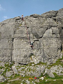 BallyryanCliff · 18 mi
Explorer Tom Ballyryan is the Burren crag that seems to have wandered up beside the coast road to show the bigger cliffs how to…
 AilladieCliff · 18 mi
Explorer Tom Ailladie is eight hundred metres of Clare limestone that makes climbers grin and makes me check where my feet are. The…
 An Trá MhórBeach / strand · 25 mi
Explorer Tom An Trá Mhór in County Galway would teach history by showing you how the tide erased every mistake people ever made on…
 Clg Micháel Breathnach GAA pitchGAA ground · 26 mi
 Coláiste CholmcilleSchool · 26 mi
Explorer Tom Coláiste Cholmcille claims its family tree is mostly made up of ancient architects who were also modernists. The…
 Graveyard in An Lochán BeagGraveyard · 26 mi
Explorer Tom An Lochán Beag wants its tombstone carved with 'Finally Got Some Sleep' in bold, angry letters. It’s tired of being the…
More archaeology and monuments in County Clare · All of County Clare

What do you know about this place?Tap to add a comment or ask a question