What is recorded here
Site levelled c. 1988, marked Bull Ring on OS 6-inch 2nd ed. Map and shows on aerial photo (GSI N 546/545) as a subcircular enclosure defined by a ditch. Not visible at ground level.
From the National Monuments Service (Archaeological Survey of Ireland) record OF011-016
The monument record does not grant public access. Check the route and ask the landowner before entering private land.
- What survives
- Recorded monument
Places near here
Victoria PlantationWood · 360 ydVictoria PlantationWood · 380 yd Rhode BridgeBridge · 674 ydToberdaly BridgeBridge · 795 ydOutlinedBawn · 891 ydFulacht fia in RathcobicanFulacht fia · 909 ydClonin EarthworksMountain / peak · 1.2 miDownan Grave YardGraveyard · 2.7 miCroghan Hill WalkWalking route · 3.0 miCroghan Hill WalkVisitor information · 3.0 miCroghan HillMountain / peak · 3.1 miCastle JordanArchaeological place · 5.7 mi
 Rhode BridgeBridge · 674 yd
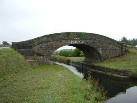 Toberdaly BridgeBridge · 795 ydOutlinedBawn · 891 ydFulacht fia in RathcobicanFulacht fia · 909 ydClonin EarthworksMountain / peak · 1.2 mi
 Downan Grave YardGraveyard · 2.7 miCroghan Hill WalkWalking route · 3.0 miCroghan Hill WalkVisitor information · 3.0 mi
 Croghan HillMountain / peak · 3.1 mi
 Castle JordanArchaeological place · 5.7 mi
Pictures: Royalcanalrunner, Wikimedia Commons · CC BY-SA 4.0; National Inventory of Architectural Heritage; Kenneth Gallery Smyth, Geograph · Creative Commons Attribution-ShareAlike 2.0; Sarah777 at en.wikipedia, Wikimedia Commons · Public domain; Mike Searle, Geograph · CC BY-SA 2.0
More archaeology and monuments in County Offaly · All of County Offaly
What do you know about this place?