What is recorded here
A standing stone is marked here on the OS 6-inch maps. It is 1.96m high. The stone stands in the midst of a large complex of stone field walls and stone enclosures some of which are buried under or sticking up out of the bog. It is not possible to say to what extent these are associated with, or are of similar date…
Read the whole record
From the National Monuments Service (Archaeological Survey of Ireland) record DG012-007002
Places near here
Photo credits
- Maker not stated on source page, marika-v.livejournal.com
- Maker not stated on source page, en.wikipedia.org
- Wanfried-Dublin, Wikimedia Commons · CC BY-SA 4.0
- Maker not stated on source page, uk.pinterest.com
- Maker not stated on source page, fi.pinterest.com
- Kenneth Allen, Geograph · Creative Commons Attribution-ShareAlike 2.0
- National Inventory of Architectural Heritage
- Maker not stated on source page, www.dreamstime.com
- Kenneth Allen, Geograph · CC BY-SA 2.0
- Kenneth Allen, Wikimedia Commons · CC BY-SA 2.0
 Stone row in KnockergranaStone row · 245 yd
Explorer Tom Stone row in Knockergrana is a proper mystery, with stones standing in lines that might predate the bog itself. It’s…
 Standing stone in KnockergranaStanding stone · 279 yd
Explorer Tom Knockergrana's standing stone was recorded at 1.96 metres high among a complicated spread of old field walls and…
 Former site of Knockergrana Court TombCourt tomb · 358 yd
Explorer Tom Former site of Knockergrana Court Tomb was blasted apart with dynamite in the early 1900s, leaving only a few slabs and…
 Kindroghed Cairn near Glacknadrummond ChurchCairn, unclassified · 393 yd
Explorer Tom Kindroghed Cairn near Glacknadrummond Church is a tangled web of stone walls and a standing stone stuck in the bog. The…
 Second Kindroghed Cairn near Glacknadrummond ChurchCairn, unclassified · 432 yd
Explorer Tom Second Kindroghed Cairn near Glacknadrummond Church is a stone maze where the bog has half-swallowed the past. A…
 Glacknadrummond Methodist ChurchChurch/chapel · 587 yd
Explorer Tom Glacknadrummond Methodist Church has stood proudly in Glackadrumman since 1850. Inside, the timber trusses and pitch…
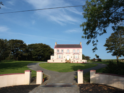 presbytery/parochial/curate's house1371 yd
Explorer Tom Presbytery in Laraghirril sits high on Mass Hill, showing off its fancy Greek-Doric doorcase like it’s a celebrity.…
 Mapped graveyardGraveyard · 1550 yd
Explorer Tom This mapped graveyard nearly got famous when a very drunk tourist claimed he saw a unicorn grazing among the…
 Clonca Old Church GraveyardGraveyard · 1.7 mi
Explorer Tom Clonca Old Church Graveyard has an early site inside a later frame: a sub-rectangular burial ground encloses the church…
 McGrory'sHotel · 1.8 mi
Explorer Tom McGrory’s in Culdaff looks like it’s been standing there since the last glacial period on Malin Road. Check if the…
 CuldaffOfficial bathing water · 1.8 mi
Explorer Tom Culdaff Beach has the good sense to offer both a big sandy stretch and smaller rocky corners, because apparently one…
 McGuinness’Pub · 1.9 mi
Explorer Tom McGuinness’ in Culdaff Main Street probably has a sign that says 'No Dogs Except This One,' showing clear favoritism. I…
More historic places in County Donegal · All of County Donegal

What do you know about this place?Tap to add a comment or ask a question