
What is recorded here
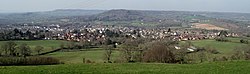
Map note: Find the recorded point for Buckerell Knap, a mountain or peak near Awliscombe, East Devon, England. A hill can keep its own counsel; the surrounding map is ready to explore.
From OpenStreetMap (© OpenStreetMap contributors) n7150958937
Places near here
Photo credits
- Derek Harper, Wikimedia Commons · CC BY-SA 2.0
- Ian Capper, Wikimedia Commons · CC BY-SA 2.0
- Roger Cornfoot, Wikimedia Commons · CC BY-SA 2.0
- Jamie DD, Wikimedia Commons · CC BY 3.0
- David Smith, Wikimedia Commons · CC BY-SA 2.0
- Gary Rogers, Wikimedia Commons · CC BY-SA 2.0
 Church of St Michael and All AngelsListed building · 772 yd
 Godford CrossListed building · 864 yd
 Rentlet PlantationWood · 1520 yd
 Pulshayes CopseWood · 1.3 mi
 Honiton ShowHeritage attraction · 1.3 mi
 Hembury FortScheduled monument · 1.4 mi
 St. Cyres' HillMountain / peak · 1.4 mi
 Monument to the 'Prayer Book Rebellion' 1549Monument or public art · 1.9 miPrayer Book RebellionMemorial · 1.9 mi
 Carpenter's HillMountain / peak · 2.0 mi
 Thelma Hulbert GalleryGallery · 2.0 mi
 LaneEnd CrossVisitor information · 2.5 mi
More mountains and hills in East Devon · All of East Devon

What do you know about this place?Tap to add a comment or ask a question