
What is recorded here
Broad Head is a mountain or peak in Dumfries and Galloway, Scotland.
From OpenStreetMap (© OpenStreetMap contributors) n7508229883
This does not grant access. Check current paths, opening conditions and ownership before entering.
Places near here
Photo credits
- Walter Baxter, Wikimedia Commons · CC BY-SA 2.0
- Richard Webb, Wikimedia Commons · CC BY-SA 2.0
- M J Richardson, Wikimedia Commons · CC BY-SA 2.0
- John Lawson, Wikimedia Commons · CC BY-SA 2.0
 Under StennieswaterFarmstead · 1509 yd
 Roughbank HeightMountain / peak · 1510 yd
 Blackgrain HeightMountain / peak · 1716 yd
 Upper StennieswaterFarmstead (post Medieval) · 1.1 mi
 The Lady Florance StoneMemorial · 1.1 mi
 SwingillBurnt Mound (prehistoric) · 1.7 mi
 Kirkton BurnBuilding (medieval) - (post Medieval), Building Platform (medieval) - (post Medieval), Enclosure(s) (medieval) - (post Medieval) · 2.0 mi
 Burnfoot PlantationWood · 2.6 mi
 War MemorialMemorial · 2.8 mi
.jpg/250px-Westerhall,_Bentspath_(geograph_1877703).jpg "Photo: John Lawson, Wikimedia Commons · CC BY-SA 2.0") WesterhallHouse (18th Century), Tower House (medieval) · 3.4 mi
WesterhallHouse (18th Century), Tower House (medieval) · 3.4 mi Gallowside WoodWood · 5.5 mi
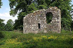 Langholm CastleTower House (16th Century) · 5.9 mi
More mountains and hills in Dumfries and Galloway · All of Dumfries and Galloway
What do you know about this place?