
What is recorded here
Situated on flat terrain in Brittas Demesne. The original castle was burnt c.1820 (Bence-Jones 1988, 48, 293) and the landowner intended replacing it with a full-scale replica of Warwick Castle. This venture was started but never finished due to the tragic death of the landowner. A sketch of the original castle in the possession of the present landowner shows three towers, two square, one circular, with intervening buildings, possibly built onto the bawn wall (TN041-012002-). The towers are approximately four storeys high with crenellated battlements and hood-mouldings over flat-headed windows and may have been part of the bawn defences. The bawn was mentioned in the Civil Survey (1654-6) (Simington 1931, vol. 1, 55). There is now a nineteenth-century house built on the site. Vol. 1 - North Tipperary' compiled by Jean Farrelly and Caimin O'Brien (Dublin: Stationery Office, 2002).
Situated on flat terrain in Brittas Demesne. The original castle was burnt c.1820 (Bence-Jones 1988, 48, 293) and the landowner intended replacing it with a full-scale replica of Warwick Castle. This venture was started but never finished due to the tragic death of the landowner. A sketch of the original castle in the possession of the present landowner shows three towers, two square, one circular, with…
From the National Monuments Service (Archaeological Survey of Ireland) record TN041-012001
The monument record does not grant public access. Check the route and ask the landowner before entering private land.
- What survives
- Recorded monument
Places near here
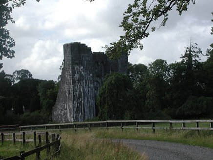 Brittas CastleCountry house · 3 yd
 Bawn in Brittas (thurles Par.)Bawn · 20 yd
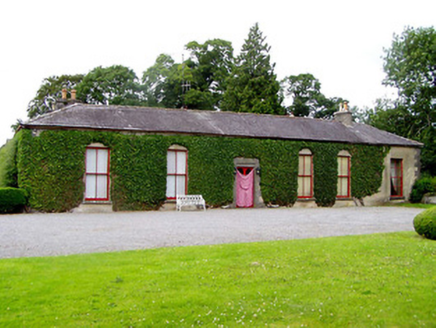 Brittas CastleCountry house · 54 yd
 Brittas CastleDemesne walls/gates/railings · 542 ydEnclosure in Brittas (thurles Par.)Enclosure · 569 yd
 European ash1.3 miSt. Mary's Famine and War MuseumMuseum · 1.7 mi
 Black CastleCastle, tower house · 1.8 mi
 Lár na PáirceMuseum · 1.8 miEuropean ash4.2 mi
 Devil's Bit MountainMountain / peak · 9.1 mi
 Grave YardGraveyard · 11 mi
Pictures: National Inventory of Architectural Heritage; Garry Dickinson, Geograph · CC BY-SA 2.0; Willow, Wikimedia Commons · CC BY 2.5; Mike Searle, Wikimedia Commons · CC BY-SA 2.0; Lár na Páirce Museum, Wikimedia Commons · CC BY 2.0; Paddy Ryan, Wikimedia Commons · CC BY-SA 4.0; Steven Brown, Geograph · Creative Commons Attribution-ShareAlike 2.0
More castles and forts in County Tipperary · All of County Tipperary
What do you know about this place?