
What is recorded here
Bridle Strip is a forest in Scottish Borders, Scotland.
From OpenStreetMap (© OpenStreetMap contributors) w131770783
This does not grant access. Check current paths, opening conditions and ownership before entering.
Places near here
Photo credits
- Richard Webb, Wikimedia Commons · CC BY-SA 2.0
- Peter Wood, Wikimedia Commons · CC BY-SA 2.0
- Bill Henderson, Wikimedia Commons · CC BY-SA 2.0
- John Walton, Wikimedia Commons · CC BY-SA 2.0
- Walter Baxter, Wikimedia Commons · CC BY-SA 2.0
- Jonathan Thacker, Wikimedia Commons · CC BY-SA 2.0
- Rude Health, Wikimedia Commons · CC BY-SA 2.0
- James T M Towill, Wikimedia Commons · CC BY-SA 2.0
 DolphinstonSettlement (iron Age) (possible) · 559 yd
 DolphinstonRoad (medieval) · 961 yd
 DovesfordSettlement (post Medieval) · 1419 yd
 Peel ClumpsForest · 1677 yd
 Camptown, BridgeRoad Bridge (19th Century) · 1690 yd
 MossburnfordCave · 1701 yd
 Flat PlantationForest · 1.4 mi
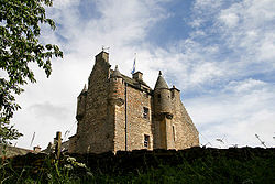 Ferniehirst CastleCastle · 2.3 mi
 Ferniehurst CastleCastle (medieval), Chapel (17th Century), Garden Wall(s) (17th Century), Gateway (17th Century) · 2.3 mi
 War MemorialMemorial · 2.9 mi
 Belling HillMountain / peak · 2.9 mi
 Jedburgh AbbeyBoundary Wall · 3.7 mi
More woods, forests and old trees in Scottish Borders · All of Scottish Borders
What do you know about this place?