Overview
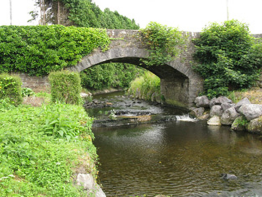
bridge — Mountcollins is recorded as bridge in Limerick. Single-span road bridge, built c. 1870, spanning the River Caher. Having camber-headed arch with rusticated limestone voussoirs and rubble stone soffit spring from rubble stone piers with rusticated tooled limestone quoins over rubble stone lined basin with weir to south-west.
Why it was built
The saved account records: Single-span road bridge, built c. 1870, spanning the River Caher.
People and work
The saved account records: Having camber-headed arch with rusticated limestone voussoirs and rubble stone soffit spring from rubble stone piers with rusticated tooled limestone quoins over rubble stone lined basin with weir to south-west.
How it changed
The saved account records: Rubble stone spandrels surmounted by splayed rubble stone parapet walls with rubble stone coping.
What survives
The saved account records: Rubble stone-faced embankments to northern bank of river abutting bridge.
Why it mattered
bridge — Mountcollins matters for the exact reasons given in its official assessment, rather than merely because it is an old structure. The source records: As an integral element of the early transport and communications network between the counties of Kerry and Limerick, this attractive road bridge is an important feature of the areas architectural heritage. The structure displays a high level of skill and craftsmanship in its construction, with features such as rusticated limestone quoins and voussoirs that form an expertly constructed arch. The visual contrast between the dressed limestone arch and the rubble stone walls also enliven the bridge faces. Located spanning the Caher River, the addition of stone embankments and a stone block basin reinforce the… This explains what the place adds to local life, the street or the surviving built history.
History checked 15 August 2026 against the named sources below.
Places near here
- house — Mountcollinsbuildingunder 0.1 miles
- Mapped graveyard — County Limerickmemorialunder 0.1 miles
- Catholic Church of Our Lady of the Assumption — Mountcollinsbuilding0.1 miles
- Enclosure in Mountcollinsmonument0.2 miles
- water pump — Mountcollinsbuilding0.2 miles
- Enclosure in Brosna Eastmonument0.2 miles
- Mountcollins Bridgebuilding0.2 miles
- Fulacht fia in Mountcollinsmonument0.3 miles
- Tobernanoonwaterfall0.6 miles
- Fulacht fia in Knockcoolkearemonument0.7 miles
- Kill Burial Gd. for Children — Cragmonument0.8 miles
- Mapped cemetery — County Limerickmemorial0.8 miles
Add the human story, a picture, a first-hand message or a missing place.
Earn 5 points after the picture is checked and accepted.
Add a pictureAdd its storyTalk or ask a questionAdd a new placeThis official record and map point do not grant access. Most recorded buildings are privately owned; view them only from public ground unless the owner allows entry.
Conversation about this place
Questions and messages sit beneath the source record. They are checked before appearing.
No questions or messages yet.
Ask a question or join the conversation