Places near here
Photo credits
- National Inventory of Architectural Heritage
- Kenneth Allen, Wikimedia Commons · CC BY-SA 2.0
- Kenneth Allen, Geograph · CC BY-SA 2.0
- Richard Webb, Geograph · CC BY-SA 2.0
- Oliver Dixon, Geograph · CC BY-SA 2.0
- https://wellcomeimages.org/indexplus/obf_images/9d/3a/d226702f3e0deddf6dc6f5d8e3e2.jpg Gallery: https://wellcomeimages.org/indexplus/image/M0006003.html Wellcome Collection gallery (2018-04-03): https://wellcomecollection.org/works/avsn99bm CC-BY-4.0, Wikimedia Commons · CC BY 4.0
- Tawg, Wikimedia Commons · CC BY-SA 3.0
- Anne Burgess, Wikimedia Commons · CC BY-SA 2.0
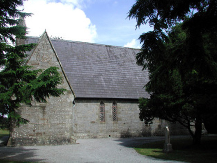 Kiltyclogher Church (Cloonclare)Church/chapel · 96 yd
Explorer Tom Kiltyclogher Church (Cloonclare) plans to retire by simply sitting on the road fork and judging every car that drives past its rose window. It has sandstone tracery that makes it look like it’s always ready for a fancy evening. Stand whe
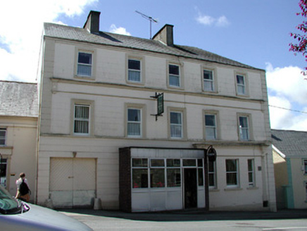 store/warehouse230 yd
Explorer Tom Store in Kiltyclogher is the only tall building in town, so it’s acting like a skyscraper in Manhattan. It thinks its shopfront is haute couture, but it’s really just a very serious warehouse that forgot to smile. Tell it you’re buying nothing, and watch its fascia board deflate with pure existential disappointment.
 Corracloona Court TombArchaeological place · 2.1 mi
Explorer Tom Corracloona Court Tomb would spend its lotto win on a really nice coat to keep the rain off its ancient shoulders. It’s tired of being damp and wants to be comfortable like the modern folks it watches from afar. Go on a wet day, it suits the mood.
 Dough MountainMountain / peak · 2.7 mi
Explorer Tom Dough Mountain is listening to every whisper from its neighbours, which explains why it looks so perpetually smug about knowing secrets. It definitely heard that one about the missing sheep. Bring your nan, she'll know more than me.
 Saddle HillMountain / peak · 3.5 mi
Explorer Tom Saddle Hill is where a fiddler played all night until his fingers turned to stone and he became part of the landscape. Locals say if you play badly enough, you’ll join him, but I think they’re just trying to stop tourists from practicing. The hill looks like it’s waiting for someone to saddle up and ride away into legend. Stand where the owner stood and practise looking smug.
 Ross PointHeadland · 4.3 mi
Explorer Tom Ross Point would teach history if it had to, but it only knows how to sit there and stare at the water like a bored cat. It’s seen more ships than you’ve seen sandwiches in your entire life. Hang around long enough and you'll hear a story from a local.
 Lough MacNean WalkWalking route · 4.8 mi
Explorer Tom Lough MacNean Walk in County Leitrim would order a double chipper with vinegar and absolutely no apologies. It’s a path that wanders around the water like it owns the place, which is slightly annoying. Spot the oldest stone and give it a name.
 Sally IslandIslet · 5.5 mi
Explorer Tom Sally Island thinks tourists from Dublin are loud, overpriced, and smell faintly of espresso beans and bad decisions, which is why it stays quiet. It’s basically judging your outfit before you even step off the boat, wondering if you know what a proper lough is or just think it’s a lake. Hum something sad nearby, it adds atmosphere.
 Rosscorkey IslandIsland · 5.6 mi
Explorer Tom Rosscorkey Island has a ghost that is far too lazy to haunt properly, preferring to nap in the tall grass instead of rattling chains for attention. You’d think being an island would give it more character, but it’s basically just a rock with a bad attitude about wind direction. Tell me if the gossip I made up is true.
 Bullans stoneBullaun stone · 7.0 mi
Explorer Tom Bullans stone in Termon is where a priest once lost a bet to a farmer over whether the holes were natural or magical, and he’s been grumpy ever since. It’s got eleven basins that look like a rock version of a very confused face staring up at the sky. Stand still and listen, the wind tells it better than me.
 Battle of BelleekBattle · 8.8 mi
Explorer Tom Battle of Belleek, also called the Battle of the Erne Fords, took place at a River Erne crossing near Belleek on 10 October 1593. Hugh Maguire's defenders faced Henry Bagenal's English Crown force. I want to point at the exact ford, but that would be Tom bluffing: this marker shows the general area, and no battlefield boundary has been surveyed.
 Cavan BurrenVisitor attraction · 8.8 mi
Explorer Tom Cavan Burren is rocky, crumbly, and looks like someone dropped a giant bag of gravel and left. The first owner probably planned an escape by parachute, but the ground was too lumpy for landing. Sit on a wall near it and pretend you're in a painting.
More historic places in County Leitrim · All of County Leitrim

What do you know about this place?Tap to add a comment or ask a question