What is recorded here
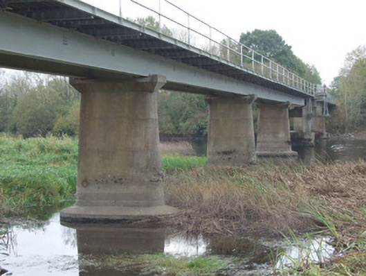
The Bridge in Kilnacarrow was built to carry peat trains across the Shannon, then given a middle that lifts for boats. A fine cure for a railway interruption: remove the railway.
Multiple-span Board na Mona railway bridge carrying narrow gauge railway line over the River Shannon. Level deck with flat steel arches. Concrete abutments and steel girders with cross and diagonal bracing supporting deck of cross beams with raised track to centre flanked by spaced boarding. Tubular steel guardrails held on edge steel channel. Tapered board-market concrete piers with rounded ends, splayed rectangular capitals and wide footings. Lifting section at centre of river, over navigation channel. Located to the north of Lanesborough Power Station (13310014), spanning border with County Roscommon to the west. Bridge spans island to centre of river.
This large-scale bridge forms part of an interesting collection of structures associated with Lanesborough Power Station (13310014). It is a notable example of mid-to-late twentieth century Government sponsored engineering, and it is a conspicuous feature in the rural landscape to the north of Lanesborough. Its construction utilises modern building materials such as (precast) reinforced concrete in the piers and structural steel for the deck, and it is an interesting addition to the twentieth century built heritage of Longford. It forms part of an extensive network of narrow gauge railway associated with Bord na Mona in this part of Longford, which is known as the Mountdillion Group of Bogs network. The railway line was originally used by Bord na Mona to transport sod peat from County Roscommon to the sidings at Lanesborough 'A' Power Station to the south. ESB’s own locomotives then hauled the wagons to the unloading point. On the closure of station 'A' in 1983, the system was redirected to supply power stations 'B' and 'C' with milled peat. The central section is designed with a lifting section to allow for the passage of traffic along the Shannon Navigation. The Bord na Mona narrow gauge railway network, and ancillary structures such as this bridge, are an important element of the twentieth century industrial and economic heritage of Ireland. Features associated with this are a common feature of the landscapes of the Bog of Allen, particularly in County Westmeath, County. Offaly County Longford and County Kildare. This bridge represents an important historical reminder of the attempts of the Irish Government(s) to create employment in the midlands and utilise peat as a natural resource on an industrial level during the mid-to-late twentieth-century, and it is of social and economic importance to Longford as a result.
From the Buildings of Ireland (National Inventory of Architectural Heritage) record 13401202
This does not grant access. Most recorded buildings are privately owned; view them only from public ground unless the owner allows entry.
Places near here
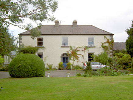 Cloonbony HouseHouse · 1.4 mi
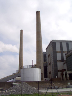 Lough Ree Power StationChimney · 1.7 miIndicatedFairy fort / earthen ringfort · 2.1 miCommons North WalkVisitor information · 2.1 miStructureStructure, peatland · 2.1 miWild birdsVisitor information · 2.4 miBallyclare IslandIslet · 2.7 miWhite Sand WoodWood · 3.0 mi
 Rathcline CastleHouse, fortified house · 3.4 mi
 Rathcline CastleBawn · 3.4 mi
 Slieve BawnMountain / peak · 3.7 miDoughill ForestForest · 3.9 mi
Pictures: National Inventory of Architectural Heritage; Mike Searle, Geograph · CC BY-SA 2.0; Kieran Campbell, Geograph · CC BY-SA 2.0; Colin Park, Geograph · CC BY-SA 2.0
More historic places in County Longford · All of County Longford
What do you know about this place?