Overview
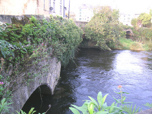
bridge — Clonmel is recorded as bridge in Tipperary. Group of three limestone bridges, spanning two branches and one former branch of River Suir and connecting Suir Island, Stretches Island and Oldbridge area. Northernmost bridge is two-arch limestone, built c.1775, aligned east-west, and renovated c.1900, having segmental arches, rubble wallings, cut limestone voussoirs and with rendered V-cut-water to north elevation.
Why it was built
The saved account records: Northernmost bridge is two-arch limestone, built c.1775, aligned east-west, and renovated c.1900, having segmental arches, rubble wallings, cut limestone voussoirs and with rendered V-cut-water to north elevation.
People and work
The saved account records: Group of three limestone bridges, spanning two branches and one former branch of River Suir and connecting Suir Island, Stretches Island and Oldbridge area.
How it changed
The saved account records: Middle bridge is three-arch, built c.1700 and renovated c.1950, aligned north-east and south-west, having segmental arches, southern being depressed, with roughly dressed quoins.
What survives
The saved account records: Southernmost bridge over dry former river channel, is five-arch, built c.1650 and widened and renovated c.1750, aligned north-south, having elliptical arches, rubble walling, narrow roughly dressed voussoirs.
Why it mattered
bridge — Clonmel matters for the exact reasons given in its official assessment, rather than merely because it is an old structure. The source records: This group of bridges, along with the medieval Old Bridge itself, is significant for linking the main part of Clonmel with the suburb of Oldbridge. The bridges have various arch types and widths and their meandering course is most attractive. They are also important for providing access to what was essentially the town's milling quarter. The antiquity of the bridges and their relationship with the River Suir are important features. This explains what the place adds to local life, the street or the surviving built history.
History checked 15 August 2026 against the named sources below.
Places near here
- store/warehouse — Suir Islandbuildingunder 0.1 miles
- Streches Islandislandunder 0.1 miles
- mill (water) — Stretches Islandbuildingunder 0.1 miles
- Creamery (site of)monumentunder 0.1 miles
- Indicated — Burgagery-Lands Westmonumentunder 0.1 miles
- Old Bridge — Clonmelbuildingunder 0.1 miles
- Suir Island Housebuildingunder 0.1 miles
- Wayside shrine — N5324471784monumentunder 0.1 miles
- Merchant's Houseviewpointunder 0.1 miles
- Grubb's Islandislandunder 0.1 miles
- Midden in Burgagery-Lands Westmonument0.1 miles
- The Green Trailwalk0.1 miles
Add the human story, a picture, a first-hand message or a missing place.
Earn 5 points after the picture is checked and accepted.
Add a pictureAdd its storyTalk or ask a questionAdd a new placeThis official record and map point do not grant access. Most recorded buildings are privately owned; view them only from public ground unless the owner allows entry.
Conversation about this place
Questions and messages sit beneath the source record. They are checked before appearing.
No questions or messages yet.
Ask a question or join the conversation