DDiscover AloneMapAbout

Bridge in Bruckless

Bridge
Bridge in Bruckless
Photo: National Inventory of Architectural Heritage · Report the wrong picture

This does not grant access. Most recorded buildings are privately owned; view them only from public ground unless the owner allows entry.

What do you know about this place?Tap to add a comment or ask a question

What you write will be public.

What is recorded here

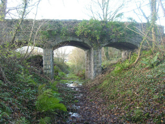
Triple-arch railway bridge, built c. 1893, carrying accommodation road serving Bruckless House (see 40909802) over the former Donegal Town to Killybegs narrow gauge railway line. Railway lines no out of use with tracks removed (c. 1960). Three concrete segmental-headed arches having concrete lining to arch barrels;…

Read the whole record
Triple-arch railway bridge, built c. 1893, carrying accommodation road serving Bruckless House (see 40909802) over the former Donegal Town to Killybegs narrow gauge railway line. Railway lines no out of use with tracks removed (c. 1960). Three concrete segmental-headed arches having concrete lining to arch barrels; coursed rock-faced sandstone masonry to the piers. Squared and coursed mildly rock-faced rubble sandstone construction to abutments, spandrels and to parapets; rock-faced sandstone coping over parapets. Located to the south-east of Bruckless and to the west of Dunkineely, at the north entrance to Bruckless House.
This former railway bridge retains its original form and character despite the closure of the line in 1960. The small arches are an interesting and rather picturesque feature, and indicate that this bridge spanned a narrow gauge railway line. The good-quality mildly rock-faced masonry (local sandstone) used in its construction is typical of Victorian railway engineering and architecture. It survives in relatively good condition, which is testament to the quality of its original construction. It was originally built by the Donegal Railway Company as part of the Donegal Town to Killybegs section of the Derry (Victoria Road) to Killybegs railway line, which opened in August 1893 and closed completely on January 1st 1960. This railway bridge forms part of a group of structures associated with this former narrow gauge railway line in the Dunkineely area, and is an important element of the built heritage and transport history of County Donegal. This bridge was built to carry the main accommodation road serving Bruckless House (see 40909802) over the railway line.

From the Buildings of Ireland (National Inventory of Architectural Heritage) record 40909837

Places near here

Picture notes
  • Ronnie Nijboer, Wikimedia Commons · CC0
  • National Inventory of Architectural Heritage
  • Computer-made picture. It does not show this monument.
  • Kenneth Allen, Wikimedia Commons · CC BY-SA 2.0
  • Malene Thyssen, Wikimedia Commons · CC BY-SA 3.0
  • Computer-made picture. It does not show this mountain top.
  • Kenneth Allen, Geograph · CC BY-SA 2.0
  • David Dixon, Wikimedia Commons · CC BY-SA 2.0
Wych Elm16 yd

Explorer Tom Wych Elm number three in County Donegal is trying to look dignified despite the wind pulling at its leaves. It needs permission to sway without falling over. Tell it to hold it together for the camera, champ.

Bruckless HouseGates/railings/walls · 37 yd

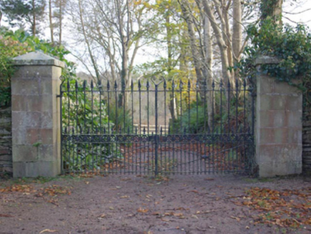
Explorer Tom Bruckless House has sandstone gate piers with iron gates and spear finials. The building record says the gateway may have been moved when a railway or later gate lodge arrived. I wonder how many people passed through without knowing its address might once have been elsewhere.

bridge256 yd

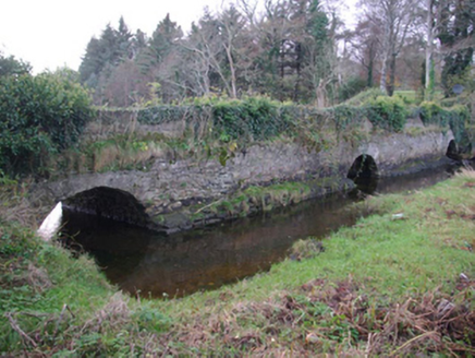
Explorer Tom Bridge in Bruckless carried the road to Killybegs over a tidal inlet from about 1775. When the building survey visited, its old road deck was a lawn in the grounds of Bruckless House: a three-arch bridge dressed for garden duty.

Structure in AighanStructure · 798 ydTom: I’m here to help · Computer-made picture. It does not show this monument.

Explorer Tom Structure in Aighan is basically a stone puzzle box on a cliff edge, hiding seven cairns and a slab with a U-notch. Patterson swears there was a dumbbell-shaped healing stone in that slot, which sounds like medieval medicine’s answer to a weighted paperweight.

Aighan Cairn in the Relig EnclosureCairn, unclassified · 810 ydTom: I’m here to help · Computer-made picture. It does not show this monument.

Explorer Tom Aighan Cairn in the Relig Enclosure hides a proper mystery in its notched slabs. Patterson swears a dumbbell-shaped 'healing stone' used to sit right there, so I bet you can still feel the local superstition lingering. Just a small rock pile with a big secret.

Killaghtee Old Church GraveyardGraveyard · 1416 yd

Explorer Tom Killaghtee Old Church Graveyard sits beside the old church; inside the graveyard, southwest of that church, the survey records a cross-inscribed slab. The Civil Survey called the church 'in reparation', and it remained in use until 1826. I like how one small mapped area holds separate records for the graveyard, church and stone.

European Beech1527 yd

Explorer Tom European Beech in County Donegal is just a tree, but a fancy one that thinks it runs the place. It’s probably been there longer than the local council has had a proper meeting. Perfect spot to practise your best tour-guide voice, say 'ahoy' and see if it flinches.

Carn More HillMountain / peak · 1709 ydTom: I’m here to help · Computer-made picture. It does not show this mountain top.

Explorer Tom Carn More Hill in County Donegal reviews its own visitors as 'mildly disappointing' and 'smells of cheap sunscreen'. It’s a peak that judges your hiking boots before you even arrive. Grand place for a sulk or a snog, your call, but keep it brief.

Drumbardack HillMountain / peak · 1.5 miTom: I’m here to help · Computer-made picture. It does not show this mountain top.

Explorer Tom Drumbardack Hill sits in County Donegal, a mountain peak with access details that remain completely unknown. The name sounds like it is trying to explain itself, but the map just offers you a polite shrug.

Tara HotelHotel · 2.2 mi

Explorer Tom Tara Hotel in Killybegs on Main Street probably has a view of the sea and some very tired fishermen. It’s the kind of place where the Wi-Fi is slow but the stories are fast.

MellysRestaurant · 2.2 mi

Explorer Tom Mellys in Killybegs serves fish and chips, which is basically a hug from the sea. Wrap it tight so the salt doesn’t ruin your phone case.

Rashenny PointHeadland · 2.4 mi

Explorer Tom Rashenny Point thinks its secret talent is competitive napping, and honestly? It’s good at it. The headland is just vibing out there in the sun. Take the long way round, because this spot deserves the extra effort and scenic drive.

More historic places in County Donegal · All of County Donegal

Add to this placeAdd a picture Add a detailed tip Add a story

Explore the map1,087,615 places to discover

Next place · or swipeWych Elm