Places near here
Photo credits
- National Inventory of Architectural Heritage
- Mike Searle, Wikimedia Commons · CC BY-SA 2.0
- Algirdas at Lithuanian Wikipedia, Wikimedia Commons · Public domain
- Sitomon, Wikimedia Commons · CC BY-SA 2.0
- Mike Searle, Geograph · CC BY-SA 2.0
- Alexander Redfern, Wikimedia Commons · CC BY-SA 4.0
- Hywel Williams, Geograph · CC BY-SA 2.0
- Chmouel Boudjnah Original uploader was Chmouel at fr.wikipedia, Wikimedia Commons · CC BY-SA 3.0
- Andreas F. Borchert, Wikimedia Commons · CC BY-SA 4.0
- Colin Park, Geograph · CC BY-SA 2.0
 mill (water)55 yd
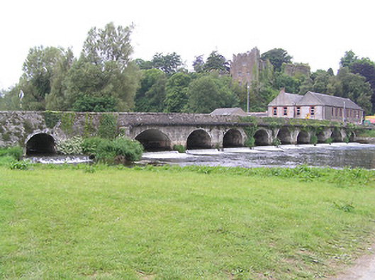
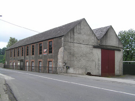
Explorer Tom The Mill in Ardfinnan has an M-shaped roof that looks like it’s doing a very dramatic impression of a mountain range. If it had to teach history class, it would just spin its wheels and let the water do the talking for it. It flows right under the bridge parapet, which is either clever or chaotic.
 Ardfinnan CastleCountry house · 106 yd
Explorer Tom Ardfinnan Castle was built on a bargain that involved a lot of mud and a King who didn't read the fine print. It dominates the village like a grandpa who knows he’s right about everything. Wave at it from a distance; it’s not exactly waving back yet.
 Ballindoney Castle (in ruins)Castle, tower house · 2.3 mi
Explorer Tom Ballindoney Castle has a fifth-storey room that looks like it’s trying to escape gravity, which is very cheeky for a stone building. A priest once lost a bet there over who could spot the sheep first. Bring your nan, she'll know more than me.
 Pedunculate Oak3.0 mi
Explorer Tom Pedunculate Oak in County Tipperary was planted by a builder who was really thinking about lunch rather than the soil composition at the time. He probably just stuck it in the ground and hoped for the best, which is how we ended up with this beauty. Leave nothing but footprints and a bad pun.
 European Yew3.7 mi
Explorer Tom This European Yew in County Tipperary has a family tree that is mostly made up by people who wanted to sound important at dinner parties. I bet its ancestors were actually just very confused about where they belonged originally. Make up your own legend and I'll swear it's true.
 Coolbane Castle (in ruins)Castle, tower house · 3.8 mi
Explorer Tom Coolbane Castle in Loughlohery was knocked down in the 1940s, so the rabbits have had eighty years to redecorate with their little droppings. The stone was carried off, probably by ghosts who really wanted to start a new life elsewhere. A good place to forget your phone for ten minutes.
 Liam Lynch MonumentMonument · 4.1 mi
Explorer Tom The Liam Lynch Monument is still counting exactly how many cups of tea it took to build this thing in the first place. Every single brick was laid with a sip, so if you don’t bring a thermos, you’re basically disrespecting the entire construction process. Bring a flask and pretend you own the place.
 The VeeViewpoint · 4.4 mi
Explorer Tom The Vee thinks the road leading to it is a bit of a wimp for being so straight and predictable all the time. It prefers to sit up here and judge everyone who drives too fast or takes selfies that don’t quite capture its majestic angle. Bring your nan along if you can, because she will absolutely know more about this hill than I ever will.
 Cahir CastleHeritage attraction · 4.9 mi
Explorer Tom I came to Cahir carrying a spade; the Suir did the work first. Cahir Castle sits in the River Suir as though someone decided a moat should come ready made. Its name remembers an older stone fort, or cathair, and the later castle grew through O'Brien and Butler hands into one of Ireland's great fortified piles. In 1599 the Earl of Essex took it after a three day siege; in 1650 it surrendered to Cromwell without a shot. I'd have offered to guard the gate, but the Butlers might have checked my references. That is quite a change in negotiating style for the same walls. The Butlers kept shaping the place, and part of the Great Hall was rebuilt in the 1840s, so what you see carries several periods at once. The state heritage service offers visits and guided information; check the current opening and tour arrangements before travelling. From the bridge, look at the towers rising out of the water and try to work out which approach you would have chosen. Sensibly, choose the visitor entrance.
Siege of Cahir CastleSiege · 5.0 miExplorer Tom The Siege of Cahir Castle happened when someone got really angry about walls and probably ran out of bread. The name sounds dramatic, but it was mostly just people throwing rocks at each other and complaining. The castle is still there, pretending it didn’t get a bit of chipping. Pick a stone, any stone, and invent its biography.
 Caher AbbeyHeritage attraction · 5.2 mi
Explorer Tom Caher Abbey in County Tipperary is secretly proud of one specific potato that grew near its wall and somehow survived the famine despite all odds. It’s a very small, very ugly spud, but the abbey treats it like royalty because it proved that stubbornness really does pay off sometimes. Wave at the cows, they're the real locals.
 KnocknaloughaMountain / peak · 6.1 mi
Explorer Tom Knocknalougha started because two lads bet on whether they could name a hill before reaching the top, and one of them lost badly. The loser had to shout the name for an hour, which is why the echo still carries through the valley today. Go on a wet day, it suits the mood.
More historic places in County Tipperary · All of County Tipperary

What do you know about this place?Tap to add a comment or ask a question