
What is recorded here
Internal diam. 17m NNW-SSE, 15m ENE-WSW. A subcircular area enclosed by a much ruined stone wall. A 10m stretch of the outer face of the wall on the NE, and a 5m stretch of the inner face on the SE, both composed of contiguously placed blocks of stone is visible in the collapsed stone. The wall is 2.35m in width along…
Read the whole record
From the National Monuments Service (Archaeological Survey of Ireland) record DG016-018
Places near here
Photo credits
- Maker not stated on source page, www.pinterest.com
- Ross, Wikimedia Commons
- Maker not stated on source page, connect.regencycenters.com
- Ross, Wikimedia Commons · CC BY-SA 2.0
- Rossographer, Geograph · CC BY-SA 2.0
- Maker not stated on source page, in.pinterest.com
- National Inventory of Architectural Heritage
- Maker not stated on source page, sempervirens.org
- Maker not stated on source page, za.pinterest.com
- Golfing in Ireland; photographer not stated, Source publisher
 Flat Rock IslandIslet · 385 yd
Explorer Tom Flat Rock Island is called flat because it apparently lost its height in a bet with the waves back in the eighties. It…
 PortnablaghOfficial bathing water · 502 yd
Explorer Tom Portnablagh beach is the sort of Donegal place that could fit in your pocket if the Atlantic would stop rearranging it…
 Buttermilk Art CafeCafé · 994 yd
Explorer Tom Buttermilk Art Cafe is serving art and dairy, which is a weirdly specific combo for County Donegal. Try the buttermilk…
 Breaghy HeadHeadland · 1057 yd
Explorer Tom Breaghy Head pushes between the beaches near Portnablagh like a Donegal storyteller keen to interrupt both sides of a…
 Shandon HotelHotel · 1108 yd
Explorer Tom Shandon Hotel near Marble Hill Strand sounds like it’s been standing there since the Viking era, judging by its…
 Mullaghadoney Old Burial GroundBurial ground · 1212 yd
Explorer Tom Mullaghadoney Old Burial Ground sits on a flat-topped rise with genuinely good views. It’s just a cluster of stones…
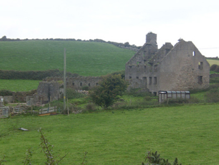 Faugher HouseCastle/fortified house, house · 1345 yd
Explorer Tom Faugher House had four rooms on each main floor, gun holes in the yard wall and a brick oven in the kitchen. Was this a…
 Bullaun stone in An Fhothair (tc An Ardaidh)Bullaun stone · 1421 yd
Explorer Tom Bullaun stone in An Fhothair is hiding out on An Ardaidh, and frankly, I think it’s doing quite well. Since the name…
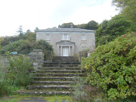 Marble HillHouse · 1556 yd
Explorer Tom Marble Hill is a house that has hosted everyone from Pádraic Pearse to William Orpen, so the ghosts must be having some…
 KillahoeyOfficial bathing water · 1.3 mi
Explorer Tom Killahoey Beach gives Dunfanaghy a splendid front garden, if your idea of gardening involves a great sheet of sand and…
 Mapped graveyardGraveyard · 1.6 mi
Explorer Tom Mapped graveyard in County Donegal thinks the road leading to it is far too modern and lacks proper character or soul.…
 Dunfanaghy Golf ClubGolf course · 1.6 mi
More archaeology and monuments in County Donegal · All of County Donegal

What do you know about this place?Tap to add a comment or ask a question