Places near here
Photo credits
- Andrew Tryon, Wikimedia Commons · CC BY-SA 2.0
- Steven Brown, Wikimedia Commons · CC BY-SA 2.0
- sylvia duckworth, Wikimedia Commons · CC BY-SA 2.0
- Jonathan Billinger, Wikimedia Commons · CC BY-SA 2.0
- Peter Moore, Wikimedia Commons · CC BY-SA 2.0
- Richard Webb, Wikimedia Commons · CC BY-SA 2.0
- Alasdair MacDonald, Wikimedia Commons · CC BY-SA 2.0
- Claire Pegrum, Wikimedia Commons · CC BY-SA 2.0
- David Bremner, Wikimedia Commons · CC BY-SA 2.0
 Cnoc An Liath-bhaidStone Circle (neolithic) - (bronze Age) · 349 yd
 Strath BroraCairnfield (prehistoric), Field System (prehistoric), Hut Circle (prehistoric) · 755 yd
 Cnoc Na H-airigh-sleibhCord Rig (prehistoric), Field System (prehistoric), Hut, Hut Circle(s) (prehistoric) · 959 yd
 GrumbyBurnt Mound (prehistoric) · 1155 yd
 CraggiemoreBank (earthwork)(s), Building (post Medieval), Mill (post Medieval) (possible), Sheepfold (19th Century) · 1620 yd
 Loch BeannachCrannog · 1.2 mi
 Cnoc Achadh Na H-uaigheHut Circle(s) (prehistoric) · 1.7 mi
 RhilochanBuilding(s) (19th Century) · 1.9 mi
 Creag RiabhachMountain / peak · 1.9 mi
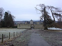 Battle of Alltan-BeathBattle · 2.5 mi
 Tosc-airighCorn Drying Kiln (post Medieval), Head Dyke (post Medieval), Township (post Medieval) · 4.0 mi
 Sir John A Macdonald Memorial CairnMemorial · 4.2 mi
More historic places in Highland · All of Highland

What do you know about this place?Tap to add a comment or ask a question