What is recorded here
Places near here
Photo credits
- Albert Bridge, Geograph · CC BY-SA 2.0
- HENRY CLARK, Wikimedia Commons · CC BY-SA 2.0
- Eric Jones, Wikimedia Commons · CC BY-SA 2.0
- P Flannagan, Geograph · CC BY-SA 2.0
- The Carlisle Kid, Wikimedia Commons · CC BY-SA 2.0
- Picture: Ulster Architectural Heritage Society image via Pinterest
- Rossographer, Geograph · CC BY-SA 2.0
- Terry Stewart, Wikimedia Commons · CC BY-SA 2.0
- HENRY CLARK, Geograph · CC BY-SA 2.0
 Whitecoat PointHeadland · 1374 yd
Explorer Tom At Whitecoat Point, the disused Newry canal meets the River Bann, offering a quiet view southeast of Portadown.
 Town Hall1.7 mi
Explorer Tom Town Hall in Portadown is having a massive feud with the bakery next door over who has the best window display, which is honestly embarrassing for both of them. It’s just trying to look official while dodging pigeons like a pro. A good place to forget your phone for ten minutes exactly.
 St. Mark's ChurchChurch · 1.7 mi
Explorer Tom St. Mark's Church in Portadown was where a priest lost a bet on a horse that didn't even exist. Visit, then text me what you think. I'll pretend to read it.
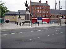 PortadownVisitor information · 1.7 mi
Explorer Tom This Portadown sign marks the site of £5.3 million public realm works, transforming the town centre beautifully. Stunning effort.
 Portadown Railway StationMemorial · 2.0 mi
Explorer Tom On this site stood Portadown Railway Station, where brave men and women once left for the battlefields of The Great War.
 Stramore HouseCastle · 2.4 mi
 Lisnamintry RathVisitor attraction · 2.5 mi
Explorer Tom Look out from Lisnamintry Rath at the rolling County Armagh hills that have watched centuries pass by.
 Medieval & Post-med. Church & Graveyard: Drumgose in DrumcreeMedieval & Post-med. Church & Graveyard: Drumgose · 3.1 mi
Explorer Tom Drumgose Church in Drumcree has survived the 90s riots and still stands proud. If it won the lotto, it’d probably buy a new roof. Bring a camera and your most suspicious face for the photo op.
 Tayto CastleCastle · 3.1 mi
Explorer Tom Tayto Castle is recorded as a castle in County Armagh, perhaps named after the famous snack brand, adding a cheeky twist to its historic architectural presence.
 Multiperiod church & graveyard with enclosure in TullylishMultiperiod Church & Graveyard with Enclosure · 4.1 mi
Explorer Tom Multiperiod church & graveyard with enclosure in Tullylish is run by a very stern dog who judges your shoes. The tower looks like it’s trying to escape the wind. Perfect place to be dramatically windswept and pretend you’re a Victorian ghost.
 Glen View TrailWalking route · 4.3 mi
Explorer Tom Follow the Glen View Trail and prepare for muddy boots as the Cusher flows through Clare Glen.
 Clare GlenWood · 4.4 mi
Explorer Tom Clare Glen wood features a weir where the Cusher flows right to left, splashing around like a happy little river dog.
More woods, forests and old trees in County Armagh · All of County Armagh

What do you know about this place?Tap to add a comment or ask a question