
What is recorded here
Bordley Stone Circle is an ancient stone or rock art in North Yorkshire, England.
From the Geograph Britain and Ireland picture record 1009477
The picture record does not grant public access. Use signed public paths and do not enter private land without permission.
Places near here
Photo credits
- Bill Harrison, Wikimedia Commons · CC BY-SA 2.0
- John Illingworth, Wikimedia Commons · CC BY-SA 2.0
- Karl and Ali, Wikimedia Commons · CC BY-SA 2.0
- Chris Heaton, Wikimedia Commons · CC BY-SA 2.0
- habiloid, Wikimedia Commons · CC BY-SA 2.0
- Maker shown on the Wikimedia Commons file page · Public domain
- Mel Towler, Wikimedia Commons · CC BY-SA 2.0
- Tim Heaton, Wikimedia Commons · CC BY-SA 2.0
- John Slater, Wikimedia Commons · CC BY-SA 2.0
_-_geograph.org.uk_-_6338034.jpg/250px-The_Druid's_Altar_(Bordley_stone_circle)_-_geograph.org.uk_-_6338034.jpg "Photo: Bill Harrison, Wikimedia Commons · CC BY-SA 2.0") Druid's AltarArchaeological place · 22 yd
Druid's AltarArchaeological place · 22 yd lime kilnRuins · 806 yd
 Kealcup PlantationWood · 1240 yd
 Wood Gill PlantationWood · 1614 yd
 Height Cave seen from Hard GateCave or cavern · 1746 yd
 Cave ScarCliff · 1751 ydHeight CaveCave · 1.0 mi
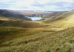 Pennine WayWalking route · 1.1 mi
 Green Haw HillMountain / peak · 1.2 mi
 New HouseListed building · 1.2 mi
 Round HillMountain / peak · 1.7 mi
 Cool ScarCliff · 1.7 mi
More archaeology and monuments in North Yorkshire · All of North Yorkshire
What do you know about this place?