What is recorded here
Booley hut in Bunnamohaun stands at the north-western edge of a small basin where eight huts cluster in pairs around a flowing stream. Tradition holds that people moved through these shallow hollows with their herds, using the paired shelters as temporary anchors during the wandering months. The western stone wall still holds rectangular blocks aligned east to west, while a large corner stone marks the limit of the room. In that narrow space, a person could have sat with a child, a pot, or a frightened dog while rain filled the basin and knocked the life out of the mountains.
This is one of eight huts (MA084-004001- to MA084-004008-) ranged in a cluster around the N and NE sides of a small natural basin or fold, through which a stream flows, on the lower SW slopes of Knockmore. A notable feature of this cluster is that the huts tend to occur in pairs. The location is locally named ‘Prawke’, and, according to tradition, the huts were associated with booleying. This hutsits on N slopes of the basin at its extreme north-western end. Another hut (MA084-004002-) lies slightly down- slope 2m to SSE. The remains comprise a small shallow hut hollow, roughly square in plan (N–S 2.2m, E–W 2.4 internally). It is defined on its northern and eastern sides by low scarps (H 0.5m max.) but its limits on the southern side are unclear, save for a large stone (L 0.6m × Wth 0.5m) in the south-eastern corner. The western side is defined by a low stone wall (Wth 0.6m × H 0.1m) including a number of rectangular blocks whose long axes are set E–W and a large stone at the north-western corner. Faint traces of a robbed-out turf stack lie immediately to W.
The above description is derived from: New Survey of Clare Island. Volume 5: Archaeology. Edited by Paul Gosling, Conleth Manning and John Waddell. (Royal Irish Academy, Dublin. 2007). In certain instances the entries have been revised and updated.
Date of upload: 29 November 2018
The monument record does not grant public access. Check the route and ask the landowner before entering private land.
- What survives
- Recorded monument
Places near here
 Enclosure in BunnamohaunEnclosure · 105 yd
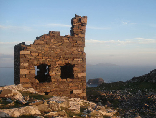 Shivel Head Signal Towersignal tower · 883 yd
 Clare Island Signal TowerRuins · 885 yd
 farm housefarm house · 894 yd
 KnockmoreMountain / peak · 1316 yd
 Clare IslandIsland · 1.5 mi
 ScalpatruceMountain / peak · 1.6 mi
 Granuaile's CastleCastle · 3.4 mi
 Acaill BheagIsland · 5.5 mi
 Turloughbeg StrandBeach / strand · 6.0 mi
 Kildavnet CastleCastle, tower house · 6.6 mi
 Caisle án GhráinneHeritage attraction · 6.6 mi