Places near here
Photo credits
- Kenneth Allen, Geograph · Creative Commons Attribution-ShareAlike 2.0
- Oliver Dixon, Geograph · CC BY-SA 2.0
- Jon Sullivan, Wikimedia Commons · Public domain
- Oliver Dixon, Wikimedia Commons · CC BY-SA 2.0
- Mcg sean, Wikimedia Commons · CC BY-SA 3.0
- Jo and Steve Turner, Geograph · CC BY-SA 2.0
- National Inventory of Architectural Heritage
- N Chadwick, Geograph · CC BY-SA 2.0
- Kenneth Allen, Geograph · CC BY-SA 2.0
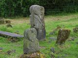
 Stone Figures in Caldragh Graveyard: Boa Island in DreenanStone Figures in Caldragh Graveyard: Boa Island · 12 yd
Explorer Tom Stone Figures in Caldragh Graveyard: Boa Island has a face looking from opposite sides, which is very confusing for geology. Best seen with a hangover and a sausage roll.
 Sallow IslandIslet · 1516 yd
 Boa IslandIsland · 1.3 mi
 Inishkeeragh BridgeBridge · 1.4 mi
Explorer Tom Inishkeeragh Bridge has a hidden message in its stones that only shows up when you’re drunk or very confused. Bring a camera and your most suspicious face.
 Castle McGrathCastle, tower house · 2.1 mi
Explorer Tom Castle McGrath was called a 'prittie castle' in a 1611 account, but I would give its five-storey tower-house and gun-looped bawn a sterner name. Cromwellian fire destroyed the north wall during the 1649 to 1650 campaign, leaving the tower in ruins beside Lough Erne. 'Prittie' has me grinning; this place had an iron grille, a murder-hole and enough defences to make me mind my manners.
 Cruninish IslandIsland · 2.2 mi
 Belalt BridgeBridge · 2.6 mi
Explorer Tom Belalt Bridge has been crossing the Waterfoot River since around 1800 and looks properly overgrown now. The triple arches are hidden by vegetation, but the masonry is still there for those who look closely. Whisper to the bridge if you can find it!
 Cliffs of MaghoViewpoint · 3.1 mi
 Pettigo InnRestaurant · 3.3 mi
Explorer Tom Pettigo Inn is full of people talking about Pettigo as if it were Paris right now. Nod along and order the special; you won’t know what it is until it hits your tongue with a punch. Best seen with a hangover and a sausage roll.
 Britton’s BarPub · 3.3 mi
Explorer Tom Britton’s Bar in Pettigo dates from eighteen sixty and smells like old wood and last calls. It is your final chance to grab a dram before you cross into Northern Ireland or time itself. A good place to forget your phone for ten minutes.
 Castle, Bawn & Village Site: Tully Castle in TullyCastle, Bawn & Village Site: Tully Castle · 4.2 mi
Explorer Tom Castle, Bawn & Village Site: Tully Castle in Tully is playing hide-and-seek with me. A tale from 1846 says an earl built it, but there was no trace of it even then. Take a picture for me if you pass! Tell it a joke, it's been a long time since anyone did.
 Castle Caldwell ForestWood · 4.4 mi
More archaeology and monuments in County Fermanagh · All of County Fermanagh

What do you know about this place?Tap to add a comment or ask a question